


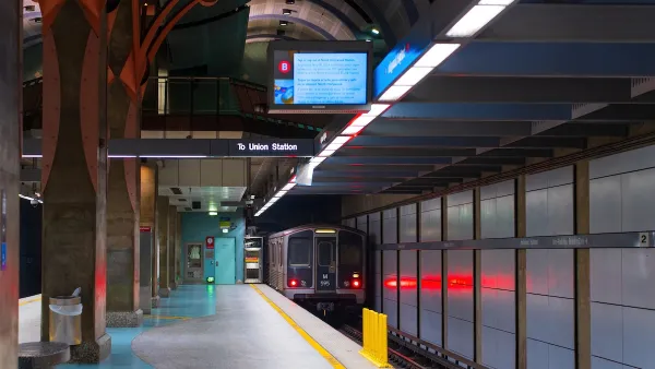
As part of his series about walking across Los Angeles, writer Ryan Bradley delves into the complicated and controversial relationship between race and transit in the city.
Los Angeles's large non-white population is also the main segment of its public transit ridership. But with a history of dedicating transit funding to white-dominated areas, the development of public transit in the city has been engulfed in controversy.
"Most everyone I've seen out walking hasn't looked like me, not just in the City of Compton (where the population is about 57 percent Latino, 40 percent black, and 1 percent white) but in the rest of Los Angeles County (where about seven out of 10 people aren't white either). To write about public transportation and walking in Los Angeles, specifically who's riding rails and buses and walking to stations and stops, I have to write about race in Los Angeles, and that can get uncomfortable real quick because, honestly, the history of Los Angeles is the history of constructing a white city in a place that isn't-never was."
Bradley discusses the conflict between the politically popular funding of rail in the city and funding buses which are used far more by a more economically insecure segment of the population.
FULL STORY: Walking in L.A.: Race and Rail Lines

LA Transit Ridership Plummets Amidst ICE Raids
LA Metro’s bus and rail lines are seeing up to 15 percent lower ridership in the wake of violent immigration arrests.
High Housing Costs Driving Down Transit Ridership in LA
When neighborhoods gentrify and displace lower-income residents, transit ridership suffers, new research shows.
LA ‘Mobility Wallet’ Increased Quality of Life for Participants
The city distributed a monthly $150 transportation subsidy to 1,000 low-income Angelenos. It dramatically improved their lives.

Planetizen Federal Action Tracker
A weekly monitor of how Trump’s orders and actions are impacting planners and planning in America.

Maui's Vacation Rental Debate Turns Ugly
Verbal attacks, misinformation campaigns and fistfights plague a high-stakes debate to convert thousands of vacation rentals into long-term housing.

San Francisco Suspends Traffic Calming Amidst Record Deaths
Citing “a challenging fiscal landscape,” the city will cease the program on the heels of 42 traffic deaths, including 24 pedestrians.

Amtrak Rolls Out New Orleans to Alabama “Mardi Gras” Train
The new service will operate morning and evening departures between Mobile and New Orleans.

The Subversive Car-Free Guide to Trump's Great American Road Trip
Car-free ways to access Chicagoland’s best tourist attractions.

San Antonio and Austin are Fusing Into one Massive Megaregion
The region spanning the two central Texas cities is growing fast, posing challenges for local infrastructure and water supplies.
Urban Design for Planners 1: Software Tools
This six-course series explores essential urban design concepts using open source software and equips planners with the tools they need to participate fully in the urban design process.
Planning for Universal Design
Learn the tools for implementing Universal Design in planning regulations.
Heyer Gruel & Associates PA
JM Goldson LLC
Custer County Colorado
City of Camden Redevelopment Agency
City of Astoria
Transportation Research & Education Center (TREC) at Portland State University
Jefferson Parish Government
Camden Redevelopment Agency
City of Claremont