


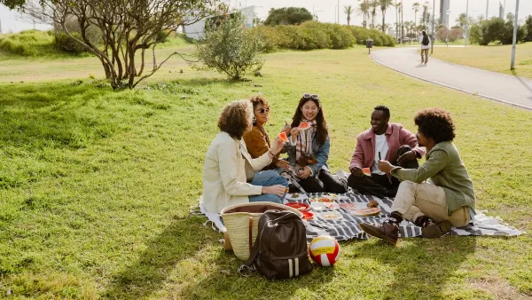
Efforts to desegregate schools in the 1970s weakened neighborhood ties. Now, a return to school assignments based on where children live could make communities stronger.
Back in the day, local public schools defined the city of Seattle, says essayist Knute Berger, who writes, "The first question Seattleites used to ask each other was "Where did you go to school?" They'd answer Franklin, Garfield, Rainier Beach, Ballard, Roosevelt, Lincoln, Queen Anne. It was short-hand for telling them all about yourself...it was the starting point for establishing common ground."
Berger contends mandatory busing policies changed that social fabric. While many cities, including Seattle, have dropped busing polices, now is the time to re-establish schools as neighborhood hubs.
Converting school assignment policies to place students in neighborhood schools eliminates choice, a bad thing for families who want to give their children the best education options possible. Berger says to make a neighborhood schools strategy work, safety issues need to be addressed, affordable housing needs to be made available within walking distance of schools, and streets must be made bike and pedestrian friendly.
These tactics are hallmarks of neighborhood sustainability efforts. By making neighborhood schools better places, cities are improved for all citizens.
FULL STORY: How schools can help save neighborhoods

Learning from Chicago's Schools
As the north side of Chicago has gentrified, many Chicago schools' test scores have improved- evidence that if a city neighborhood attracts enough affluent families, its schools will become more attractive as well.
Parks: Essential Community Infrastructure — and a Smart Investment
Even during times of budget constraint, continued investment in parks is critical, as they provide proven benefits to public health, safety, climate resilience, and community well-being — particularly for under-resourced communities.
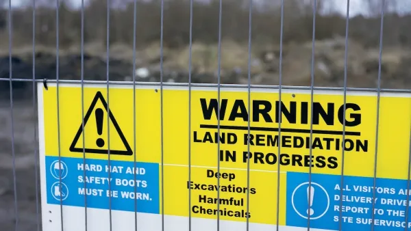
EPA Awards $267 Million to Clean Up and Reuse Contaminated Sites
The EPA is investing the funds to clean up and redevelop contaminated sites nationwide, supporting economic growth, community revitalization, and environmental restoration.

Planetizen Federal Action Tracker
A weekly monitor of how Trump’s orders and actions are impacting planners and planning in America.

Map: Where Senate Republicans Want to Sell Your Public Lands
For public land advocates, the Senate Republicans’ proposal to sell millions of acres of public land in the West is “the biggest fight of their careers.”

Restaurant Patios Were a Pandemic Win — Why Were They so Hard to Keep?
Social distancing requirements and changes in travel patterns prompted cities to pilot new uses for street and sidewalk space. Then it got complicated.

Platform Pilsner: Vancouver Transit Agency Releases... a Beer?
TransLink will receive a portion of every sale of the four-pack.

Toronto Weighs Cheaper Transit, Parking Hikes for Major Events
Special event rates would take effect during large festivals, sports games and concerts to ‘discourage driving, manage congestion and free up space for transit.”

Berlin to Consider Car-Free Zone Larger Than Manhattan
The area bound by the 22-mile Ringbahn would still allow 12 uses of a private automobile per year per person, and several other exemptions.
Urban Design for Planners 1: Software Tools
This six-course series explores essential urban design concepts using open source software and equips planners with the tools they need to participate fully in the urban design process.
Planning for Universal Design
Learn the tools for implementing Universal Design in planning regulations.
Heyer Gruel & Associates PA
JM Goldson LLC
Custer County Colorado
City of Camden Redevelopment Agency
City of Astoria
Transportation Research & Education Center (TREC) at Portland State University
Camden Redevelopment Agency
City of Claremont
Municipality of Princeton (NJ)