


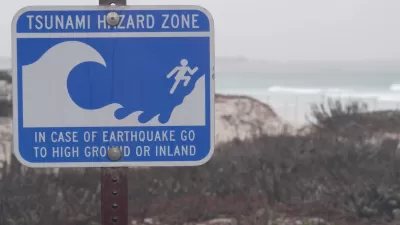
The event of a huge earthquake off the Aleutian Islands could send a devastating tsunami towards the West coast of the U.S. Researchers have released maps of what a worst-case scenario might look like for coastal communities.
"The danger has long been known, but Thursday a team of state scientists and emergency management specialists announced they have completed an updated series of 135 "inundation maps" covering shoreline areas in the state's 30 coastal counties and every harbor and inlet that could be threatened.
The maps reveal in detail just how far large tsunamis might send ocean waters rushing inland to threaten beaches and coastal towns. They also indicate evacuation routes that lead to higher ground. The maps are being released online today by the California Emergency Management Agency."
Waves could rise more than 20 feet, inundating many of the state's coastal cities.
FULL STORY: Maps show where tsunami floods would hit state

Washington State Requests Federal Funding for Tsunami Preparedness
The state’s Department of Natural Resources says it needs continued funding to map coastal areas at risk for tsunami impacts and prepare mitigation and evacuation plans.
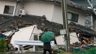
When the Earth Turns to Liquid
A 7.5 magnitude earthquake struck the Indonesian island of Sulawesi on Sept. 25, followed by a massive tsunami. Soil liquefaction caused by the tremor resulted in 1,700 homes being "swallowed" as the soil shifted. Deaths exceeded 1,400 on Oct. 3.
The Scary, Likely Event of the 'Really Big One' in the Pacific Northwest
Forget Hollywood's proclivity for destroying Los Angeles and San Francisco in movies like San Andreas—the greatest seismic threat in North America is in the Pacific Northwest.

Planetizen Federal Action Tracker
A weekly monitor of how Trump’s orders and actions are impacting planners and planning in America.

Congressman Proposes Bill to Rename DC Metro “Trump Train”
The Make Autorail Great Again Act would withhold federal funding to the system until the Washington Metropolitan Area Transit Authority (WMATA), rebrands as the Washington Metropolitan Authority for Greater Access (WMAGA).

The Simple Legislative Tool Transforming Vacant Downtowns
In California, Michigan and Georgia, an easy win is bringing dollars — and delight — back to city centers.

The States Losing Rural Delivery Rooms at an Alarming Pace
In some states, as few as 9% of rural hospitals still deliver babies. As a result, rising pre-term births, no adequate pre-term care and "harrowing" close calls are a growing reality.

The Small South Asian Republic Going all in on EVs
Thanks to one simple policy change less than five years ago, 65% of new cars in this Himalayan country are now electric.

DC Backpedals on Bike Lane Protection, Swaps Barriers for Paint
Citing aesthetic concerns, the city is removing the concrete barriers and flexposts that once separated Arizona Avenue cyclists from motor vehicles.
Urban Design for Planners 1: Software Tools
This six-course series explores essential urban design concepts using open source software and equips planners with the tools they need to participate fully in the urban design process.
Planning for Universal Design
Learn the tools for implementing Universal Design in planning regulations.
Smith Gee Studio
City of Charlotte
City of Camden Redevelopment Agency
City of Astoria
Transportation Research & Education Center (TREC) at Portland State University
US High Speed Rail Association
City of Camden Redevelopment Agency
Municipality of Princeton (NJ)