


MIT's SENSEable City Lab is featuring a prototype of a futuristic bus stop, complete with real-time route mapping, e-ink surfaces, and estimates of your exposure to pollutants along the way.
FROM THE PRESS RELEASE:
"At the touch of a finger users can indicate their desired destination; the system will then display the shortest bus route from where they are and the position of all relevant buses real?time. The EyeStop will glow at different levels of intensity to signal the distance of an approaching bus. Riders and passers?by can also post
ads and community announcements to an electronic bulletin board placed on the bus stop, enhancing its functionality as a public space ? a place to gather and exchange community relevant information.
In addition to displaying information, the bus stop also acts as an active environmental sensing node, powering itself through sunlight and collecting real time information about air quality and the urban environment. "EyeStop is an experiment into urban computing: it may be considered an 'info?tape' that snakes through the city, rising up like a pole or cropping out of the sidewalk like a shelter. It senses information about the environment and distributes it in a form accessible to all citizens,"commented project leader Giovanni de
Niederhousern."
FULL STORY: EyeStop


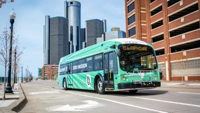
Detroit Transit Agency Requests $20M Budget Increase
The Detroit Department of Transportation wants to boost ridership by hiring more drivers, buying new buses, and enhancing station infrastructure.
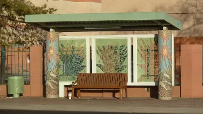
Analysis: Just 5 Percent of Detroit Bus Stops Have Shelters
The city’s thousands of bus stops are sorely lacking in seating and shelters to protect riders from rain, snow, and sun.
Phoenix Shade Plan Focuses on Bus Stops
The city’s updated Shade Master Plan calls for trees and built structures at bus stops to protect residents from heat.

Planetizen Federal Action Tracker
A weekly monitor of how Trump’s orders and actions are impacting planners and planning in America.

Restaurant Patios Were a Pandemic Win — Why Were They so Hard to Keep?
Social distancing requirements and changes in travel patterns prompted cities to pilot new uses for street and sidewalk space. Then it got complicated.

Map: Where Senate Republicans Want to Sell Your Public Lands
For public land advocates, the Senate Republicans’ proposal to sell millions of acres of public land in the West is “the biggest fight of their careers.”

Maui's Vacation Rental Debate Turns Ugly
Verbal attacks, misinformation campaigns and fistfights plague a high-stakes debate to convert thousands of vacation rentals into long-term housing.

San Francisco Suspends Traffic Calming Amidst Record Deaths
Citing “a challenging fiscal landscape,” the city will cease the program on the heels of 42 traffic deaths, including 24 pedestrians.

California Homeless Arrests, Citations Spike After Ruling
An investigation reveals that anti-homeless actions increased up to 500% after Grants Pass v. Johnson — even in cities claiming no policy change.
Urban Design for Planners 1: Software Tools
This six-course series explores essential urban design concepts using open source software and equips planners with the tools they need to participate fully in the urban design process.
Planning for Universal Design
Learn the tools for implementing Universal Design in planning regulations.
Heyer Gruel & Associates PA
JM Goldson LLC
Custer County Colorado
City of Camden Redevelopment Agency
City of Astoria
Transportation Research & Education Center (TREC) at Portland State University
Camden Redevelopment Agency
City of Claremont
Municipality of Princeton (NJ)