


This article from The New York Observer looks at how New York City might be different with more "livable streets".
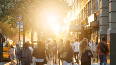
"The Dutch call it a woonerf-a "livable street" resplendent with wide sidewalks, ample retail, greenery and minimal automobile traffic. It's designed to boost quality of life for citizenry, the till for retailers and property values for landowners. Perhaps you've noticed that New York City doesn't have many woonerfs amid its warren of streets, which make up one-fourth of the city's land area."
"But what if it did?"
"Retail sales and property values would jump; pollution and noise would drop; and contentment among those lucky enough to live near or on a livable street would abound. That's the idyllic outcome, according to a preliminary report shared with The Observer by the nonprofit group Transportation Alternatives. (The report is out officially Aug. 6.) The report aggregated studies of livable streets performed in other cities and found tangible benefits-not Valhalla, perhaps, but serious economic and social benefits that might be replicated in New York."
Thanks to Streetsblog
FULL STORY: The Woonerf Deficit

A Fair Share for Walking
Most people value walkability, yet most communities underinvest in pedestrian facilities. Some jurisdictions are investing more in sidewalks and crosswalks in order to better serve community values.
Effort to Make NYC Streets Safer Paying Dividends
Jane E. Brody reports on the safety features New York City has instituted as part of an ambitious effort to completely re-engineer city streets.
Streetsblog: Advocacy Journalism and the Reconquering of the American City
The Internet is a trove of great ideas about improving cities. Filling blogs and personal websites, the vast majority of ideas out there are little more than that: ideas. New York City's Streetsblog -- now a growing nationwide force -- is transforming the conversation into action.

Maui's Vacation Rental Debate Turns Ugly
Verbal attacks, misinformation campaigns and fistfights plague a high-stakes debate to convert thousands of vacation rentals into long-term housing.

Planetizen Federal Action Tracker
A weekly monitor of how Trump’s orders and actions are impacting planners and planning in America.

San Francisco Suspends Traffic Calming Amidst Record Deaths
Citing “a challenging fiscal landscape,” the city will cease the program on the heels of 42 traffic deaths, including 24 pedestrians.

Defunct Pittsburgh Power Plant to Become Residential Tower
A decommissioned steam heat plant will be redeveloped into almost 100 affordable housing units.

Trump Prompts Restructuring of Transportation Research Board in “Unprecedented Overreach”
The TRB has eliminated more than half of its committees including those focused on climate, equity, and cities.

Amtrak Rolls Out New Orleans to Alabama “Mardi Gras” Train
The new service will operate morning and evening departures between Mobile and New Orleans.
Urban Design for Planners 1: Software Tools
This six-course series explores essential urban design concepts using open source software and equips planners with the tools they need to participate fully in the urban design process.
Planning for Universal Design
Learn the tools for implementing Universal Design in planning regulations.
Heyer Gruel & Associates PA
JM Goldson LLC
Custer County Colorado
City of Camden Redevelopment Agency
City of Astoria
Transportation Research & Education Center (TREC) at Portland State University
Jefferson Parish Government
Camden Redevelopment Agency
City of Claremont