


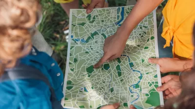
Ubiquitous access to GPS data and social software is generating a whole new breed of cartographers who are empowering themselves and others by mapping everything from community assets to occurrence of disease.
"Maps are everywhere these days. The ubiquity of global positioning systems (GPS) and mobile directional devices, interactive mapping tools and social networks is feeding a mapping boom. Amateur geographers are assigning coordinates to everything they can get their hands on-and many things they can't. "Locative artists" are attaching virtual installations to specific locales, generating imaginary landscapes brought vividly to life in William Gibson's latest novel, Spook Country. Indeed, proponents of "augmented reality" suggest that soon our current reality will be one of many "layers" of information available to us as we stroll down the street.
Multimedia designer Sha Sha Feng recently completed a Master of Fine Arts project at Hunter College in New York titled "MapaboutMaps," using Google Earth as a platform to host video interviews about new directions in mapping with geographers, artists and programmers.
Feng was particularly interested in examining the role maps can play in building community. She interviewed Wendy Brawer, the founder of Greenmap Systems, a website that engages local mapping teams to chart their communities' natural and green living landmarks, including farmers markets, organic food producers, fair trade shops, indigenous sites and the best spots for star-gazing. "Maps are very personal objects," says Brawer. "People look for themselves on them."
Participatory mapping tools have "opened the world of maps from a few to many," says Feng. "Maps are powerful tools. Many people take them as fact, but they tell the story that the creator wants you to see. Grassroots communities and artists welcome this technology because it allows their voices to be heard."
In many ways, these mapping tools are re-locating us as the center of our personal universes. We no longer go to maps to find out where we are. Instead, we tell maps where we are and they form around us on the fly, a sensation that can be comforting or stifling. After all, while finding the right map can orient you, having dozens can threaten to tip the signal-to-noise ratio toward cacophony.
On balance, though, the democratization of mapping and visualization tools generates possibilities for self-expression and social action. Two decades ago, postmodern theorist Frederic Jameson argued that developing new maps would be central for activists hoping to grapple with the emerging global business and communication systems. "[The] incapacity to map socially is as crippling to political experience as the analogous incapacity to map spatially is for urban experience," he wrote.
The tools are now available. The question now: Where do we go from here?"
FULL STORY: The New Cartographers


Trump Cuts Decimate Mapping Agency
The National Geodetic Survey maintains and updates critical spatial reference systems used extensively in both the public and private sectors.

New Book Shows How Geographic Technology Tackles Global Challenges
In his new book, Jack Dangermond explores the transformative impact of GIS technology in solving global challenges through spatial data, highlighting its widespread application across sectors and its potential to design sustainable futures.
Building Healthier Communities: The Role of GIS in Park Planning
Integrating Geographic Information Systems (GIS) into park planning enhances community health by promoting physical activity, supporting mental well-being, fostering social connectedness, and addressing public health crises and climate change.

Planetizen Federal Action Tracker
A weekly monitor of how Trump’s orders and actions are impacting planners and planning in America.

Maui's Vacation Rental Debate Turns Ugly
Verbal attacks, misinformation campaigns and fistfights plague a high-stakes debate to convert thousands of vacation rentals into long-term housing.

Restaurant Patios Were a Pandemic Win — Why Were They so Hard to Keep?
Social distancing requirements and changes in travel patterns prompted cities to pilot new uses for street and sidewalk space. Then it got complicated.

In California Battle of Housing vs. Environment, Housing Just Won
A new state law significantly limits the power of CEQA, an environmental review law that served as a powerful tool for blocking new development.

Boulder Eliminates Parking Minimums Citywide
Officials estimate the cost of building a single underground parking space at up to $100,000.

Orange County, Florida Adopts Largest US “Sprawl Repair” Code
The ‘Orange Code’ seeks to rectify decades of sprawl-inducing, car-oriented development.
Urban Design for Planners 1: Software Tools
This six-course series explores essential urban design concepts using open source software and equips planners with the tools they need to participate fully in the urban design process.
Planning for Universal Design
Learn the tools for implementing Universal Design in planning regulations.
Heyer Gruel & Associates PA
JM Goldson LLC
Custer County Colorado
City of Camden Redevelopment Agency
City of Astoria
Transportation Research & Education Center (TREC) at Portland State University
Jefferson Parish Government
Camden Redevelopment Agency
City of Claremont