


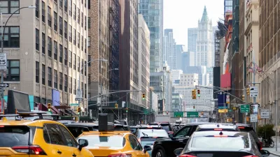
BEIJING, 9 MAY 2007--Anyone questioning China's potential to become the dominant player in the 21st century and beyond need look no further than the Beijing Transportation Information Center. The entrepreneurial leader of the center, Mr. WANG gang, has lead the development of the most innovative system for managing traffic congestion I've seen, putting U.S. systems to shame and leapfrogging over London's cutting edge signal coordinatin system. Rather than try to regulate congestion by limiting automobile use, they have figured out a way to use technology to make its use more efficient.

BEIJING, 9 MAY 2007--Anyone questioning China's potential to become the dominant player in the 21st century and beyond need look no further than the Beijing Transportation Information Center. The entrepreneurial leader of the center, Mr. WANG gang, has lead the development of the most innovative system for managing traffic congestion I've seen, putting U.S. systems to shame and leapfrogging over London's cutting edge signal coordinatin system. Rather than try to regulate congestion by limiting automobile use, they have figured out a way to use technology to make its use more efficient.
Using GPS technology and mapping, they've given individual travelers the means to spontaneously find the quickest, most efficient route to their destination quickly and easily. Any driver can already go to the city's website to find out if their route is congested. The traffic map tracks congestion on each road, color coding it for severe congestion (red), moderate congestion (yellow), and uncongested (green). Take a look at the map, which is updated every five seconds. The system is enabled by GPS chips traveling in 10,000 taxis throughout the city to give real time traffic conditions.
Then--and here's the innovative part--travelers can input their point of origin and destination. The system will plot the route, including distance and travel time. Then, the system will calculate the fastest alternative route. At our demonstration, which used a prototype touchscreen computer screen, going from downtown to the airport would usually be a 47 km trip. The fastest trip, however, was the 51 km route that used the fourth ring road.
Inaugurated in April 2006, the web site received 300,000 hits per day during its first week of use! The center is now looking for private partners to adapt the technology to cell phones and even install screens at public transit stations.
Leave it to Communist China to come up with a consumer-oriented, technology that makes traveling in the city faster and easier while recognizing the critical role the private sector plays in making it become a universal reality!
The Beijing system should be front and center at the National League of Cities, the Transportation Research Board, AASHTO, and any other group interested in improving urban mobility.


NYC Congestion Pricing Continues to Show Positive Results
While the Trump administration attempts to revoke the program’s federal approval, congestion pricing continues to reduce traffic, speed up bus travel times, and improve air quality in Manhattan.
Agreement Keeps NYC Congestion Pricing Alive Through Summer
The tolling program will continue while a court considers the city’s lawsuit against the Trump administration.
NYC Congestion Pricing Goes Into Effect
The long-awaited congestion pricing program began on January 5.

Planetizen Federal Action Tracker
A weekly monitor of how Trump’s orders and actions are impacting planners and planning in America.

Map: Where Senate Republicans Want to Sell Your Public Lands
For public land advocates, the Senate Republicans’ proposal to sell millions of acres of public land in the West is “the biggest fight of their careers.”

Restaurant Patios Were a Pandemic Win — Why Were They so Hard to Keep?
Social distancing requirements and changes in travel patterns prompted cities to pilot new uses for street and sidewalk space. Then it got complicated.

Platform Pilsner: Vancouver Transit Agency Releases... a Beer?
TransLink will receive a portion of every sale of the four-pack.

Toronto Weighs Cheaper Transit, Parking Hikes for Major Events
Special event rates would take effect during large festivals, sports games and concerts to ‘discourage driving, manage congestion and free up space for transit.”

Berlin to Consider Car-Free Zone Larger Than Manhattan
The area bound by the 22-mile Ringbahn would still allow 12 uses of a private automobile per year per person, and several other exemptions.
Urban Design for Planners 1: Software Tools
This six-course series explores essential urban design concepts using open source software and equips planners with the tools they need to participate fully in the urban design process.
Planning for Universal Design
Learn the tools for implementing Universal Design in planning regulations.
Heyer Gruel & Associates PA
JM Goldson LLC
Custer County Colorado
City of Camden Redevelopment Agency
City of Astoria
Transportation Research & Education Center (TREC) at Portland State University
Camden Redevelopment Agency
City of Claremont
Municipality of Princeton (NJ)