


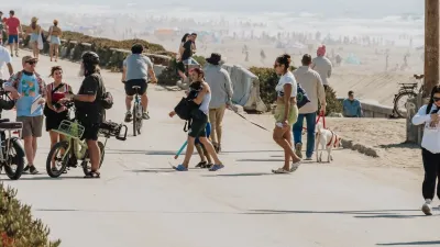
New developments have clear rules for ensuring surrounding roads, water, and sewers can handle new users. Why not do the same for community amenities?

In a piece for Happy Cities, Emma Avery describes Happy Cities’ effort to address the challenges of elevating social infrastructure to the same importance as other civic amenities. “Our research aims to support municipalities in this process by collecting data and developing policy tools, recognizing that many municipalities are already overstretched trying to meet essential community needs.”
As Avery explains, “When someone proposes a new development, they must work with the city to ensure that roads, water, and sewage have the capacity to service new homes and businesses.” But when it comes to social spaces, cities usually make decisions case-by-case, leading to uneven levels of community facilities and services.
Social infrastructure is more than just amenities or buildings—it encompasses the social networks and programs that bring shared spaces to life, and creates the foundation for thriving, healthy communities.
Elevating social infrastructure to the same importance, and developing tools and metrics to measure its actual impact, “could help cities understand whether, for example, a new development has enough park space or child care nearby to support its future residents,” Avery writes.
FULL STORY: The case for social infrastructure


How South LA Green Spaces Power Community Health and Hope
Green spaces like South L.A. Wetlands Park are helping South Los Angeles residents promote healthy lifestyles, build community, and advocate for improvements that reflect local needs in historically underserved neighborhoods.
San Francisco Opens Park on Former Great Highway
The Sunset Dunes park’s grand opening attracted both fans and detractors.
Parklet Symposium Highlights the Success of Shared Spaces
Parklets got a boost during the Covid-19 pandemic, when the concept was translated to outdoor dining programs that offered restaurants a lifeline during the shutdown.

Planetizen Federal Action Tracker
A weekly monitor of how Trump’s orders and actions are impacting planners and planning in America.

Map: Where Senate Republicans Want to Sell Your Public Lands
For public land advocates, the Senate Republicans’ proposal to sell millions of acres of public land in the West is “the biggest fight of their careers.”

Restaurant Patios Were a Pandemic Win — Why Were They so Hard to Keep?
Social distancing requirements and changes in travel patterns prompted cities to pilot new uses for street and sidewalk space. Then it got complicated.

DC Area County Eliminates Bus Fares
Montgomery County joins a growing trend of making transit free.

Platform Pilsner: Vancouver Transit Agency Releases... a Beer?
TransLink will receive a portion of every sale of the four-pack.

Toronto Weighs Cheaper Transit, Parking Hikes for Major Events
Special event rates would take effect during large festivals, sports games and concerts to ‘discourage driving, manage congestion and free up space for transit.”
Urban Design for Planners 1: Software Tools
This six-course series explores essential urban design concepts using open source software and equips planners with the tools they need to participate fully in the urban design process.
Planning for Universal Design
Learn the tools for implementing Universal Design in planning regulations.
Heyer Gruel & Associates PA
JM Goldson LLC
Custer County Colorado
City of Camden Redevelopment Agency
City of Astoria
Transportation Research & Education Center (TREC) at Portland State University
Camden Redevelopment Agency
City of Claremont
Municipality of Princeton (NJ)