


The city’s updated Shade Master Plan calls for trees and built structures at bus stops to protect residents from heat.
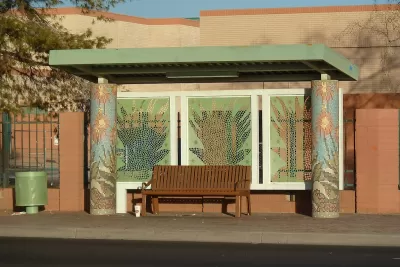
A “shade plan” developed by the city of Phoenix takes aim at extreme heat with street trees and “engineered shade” to protect residents at bus stops and in other public spaces. As Ysabelle Kempe notes in Smart Cities Dive, “The recently approved plan is an update and expansion of Phoenix’s 2010 Tree and Shade Master Plan.”
The new plan takes a more focused approach to shade, targeting bus stops first. The new approach comes in part as an admission that the city can’t afford to meet its initial blanket goal of shading 30 percent of Phoenix by 2030, but also refocuses efforts on communities that currently lack shade infrastructure. According to Jacob Koch, who helped the city create the plan, “We want to increase the canopy in the places that need it most and that have not had the same level of investment and public infrastructure, historically.”
According to Kempe, “City officials in Phoenix know that more must be done to increase shade beyond the actions outlined in the plan. The document specifically calls out the need to secure more sustained funding sources for this work and to improve the budget and practices for maintaining trees and built shade structures.”
FULL STORY: Not just trees: Phoenix’s $60M shade plan includes built structures, too


How Extreme Heat Impacts Heart Health
A higher number of high heat days correlates with more cardiovascular deaths, according to new research.
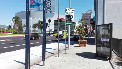
Study: One-Quarter of L.A. County Bus Stops Equipped With Shelters
Bus riders in Los Angeles frequently lack protection from sun and extreme heat, with bus stops in some of the county’s hottest areas having the worst amenities.

Phoenix Announces Shade Action Plan
The city has outlined 11 strategic priorities aimed at addressing the risks of extreme heat and protecting vulnerable residents from its impacts.

Planetizen Federal Action Tracker
A weekly monitor of how Trump’s orders and actions are impacting planners and planning in America.

DARTSpace Platform Streamlines Dallas TOD Application Process
The Dallas transit agency hopes a shorter permitting timeline will boost transit-oriented development around rail stations.

Four Reasons Urban Planners Can’t Ignore AI
It’s no longer a question of whether AI will shape planning, but how. That how is up to us.

Bikeshare for the Win: Team Pedals to London Cricket Match, Beats Rivals Stuck in Traffic
While their opponents sat in gridlock, England's national cricket team hopped Lime bikes, riding to a 3-0 victory.

Amtrak’s Borealis Exceeds First Year Ridership Expectations
205,800 passengers have boarded the St. Paul to Chicago line, well above initial MDOT projections.

Study: 4% of Truckers Lack a Valid Commercial License
Over 56% of inspected trucks had other violations.
Urban Design for Planners 1: Software Tools
This six-course series explores essential urban design concepts using open source software and equips planners with the tools they need to participate fully in the urban design process.
Planning for Universal Design
Learn the tools for implementing Universal Design in planning regulations.
City of Mt Shasta
City of Camden Redevelopment Agency
City of Astoria
Transportation Research & Education Center (TREC) at Portland State University
US High Speed Rail Association
City of Camden Redevelopment Agency
Municipality of Princeton (NJ)