The Transit Equity Dashboard reveals a more marked improvement in transit access in the District of Columbia than in other metro areas.


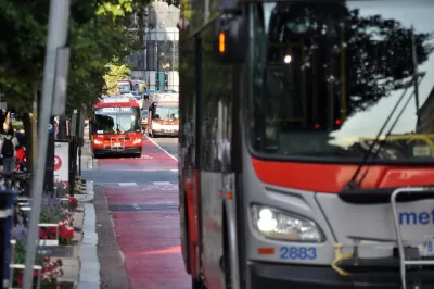
In a piece for Greater Greater Washington, Wyatt Gordon highlights the Washington Metropolitan Area Transit Authority (WMATA)’s successes in expanding services to more parts of the District of Columbia as its ridership steadily grows after pandemic-era drops.
“Some of the most significant boosts in transit access have happened in corners of the region that have needed it the most for decades, including Northern Virginia, Montgomery County, and Southeast DC. TransitCenter’s newly updated Transit Equity Dashboard makes it easy to explore the data behind the region’s ridership recovery, whether you are a policymaking professional, enthused advocate, or a data dilettante,” Gordon adds.
The dashboard can help agencies understand transportation needs in the region and how well existing transit is serving riders in various demographic groups. Hayley Richardson, communications director at TransitCenter, said “DC’s growth in access to opportunity via transit surpasses all other cities we looked at. Ridership on WMATA is bounding back faster than at other agencies which is a testament to the fact that when you put out good service, riders will come.” The results also signal the success of a shift to more frequent all-day service that moves away from focusing on 9-to-5 schedules.
However, “Besides a few pockets, nowhere in the region is public transportation truly competitive with cars. Even in much of the District itself, it takes residents three to five times longer to get their groceries via transit than it would take them by car.”
Read the full story: Mapping transit equity as the region’s ridership rebounds
A New Transit Equity Dashboard
New data technology has made it possible to measure transit equity in ways that were impossible before. TransitCenter is making good use of the new capabilities.
Report: Reduced Fare Transit Programs Reach Less Than Half of Eligible Riders
Discount programs designed to help low-income transit riders have participation rates that rarely hit 50%, signaling a lack of effective outreach to eligible households.
‘Week Without Driving’ Highlights Needs of Non-Drivers
The event encourages public officials to use their local public transit and engage with the people who rely on it every day.

Planetizen Federal Action Tracker
A weekly monitor of how Trump’s orders and actions are impacting planners and planning in America.

Eastern Nebraska is running out of electricity
Data centers and electrification are straining eastern Nebraska’s grid, throttling economic development.

Study reveals best places in the U.S. for cycling, walking
New research from Streetlight Data examines bicycle and pedestrian miles per capita in the 100 largest U.S. cities by population.

San Antonio is using environmental review to stall ICE detention center
San Antonio sued last month to pause work on the new detention center until the federal government studied its effect on the surrounding area.

Austin plans light rail extension — before breaking ground on light rail
The planned extension is three miles long and will take riders straight to Austin-Bergstrom International Airport.

Chicago cuts ribbon on $300,000, self-cleaning public toilet
The public toilet is the city’s first, and may pave the way for a rollout of similar facilities.

FREE Course: Walkable City 1: Why Walkability?
After describing his path towards focusing on walkability as the essence of good planning, Jeff Speck marches through his five principal reasons for making more walkable places.
Reinventing Malls: Planning Alchemy—Turning Gray Fields Into Gold
The course focuses on the opportunities and imperatives that shape reinvention of mall sites.

City of Charlotte
City of Rosemead
Rutgers University, Edward J. Bloustein School of Planning and Public Policy
University of Michigan School for Environment and Sustainability (SEAS)
Hunter College, City University of New York (CUNY)
The Architects Foundation
City of Cambridge
The Pocatello Development Authority
The Urban Renewal Agency of the City of Pocatello