


Curb monitoring technology is helping cities build a growing understanding of the shifting demand for this valuable urban space.
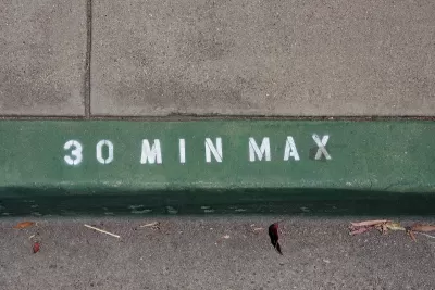
More cities are viewing their curbs as “part of a digital system to support parking, deliveries and the changing dynamic of urban life,” writes Skip Descant in Govtech.
Using technology to monitor curb usage is helping cities implement dynamic parking pricing that adjusts to demand to manage available parking space and evaluate the best uses for curbside space.
Portland, Oregon and Santa Monica, California are both testing ‘zero-emission delivery zones,’ areas in the central business districts of each city that prioritize access for zero-emission delivery vehicles. According to Descant, “Portland officials will learn about the city’s curbs via the curb analytics data collected. A portion of this data will enable them to visualize the operations of B-Line, the micro-freight operator, in the same way Portland already visualizes micromobility data.”
San Jose, California plans to use digital curb data to create its own dynamic parking pricing program. In San Francisco, officials are working to catalog physical street assets such as signage and bus stops in the same platform as curb space and parking spots to create a comprehensive directory of city assets that can help inform policy decisions.
FULL STORY: Digital Curb Data Deepens Understanding of Urban Activity


State of Curbs & Parking Report Reveals Glut of Data
As the uses of curb space become more diverse, city officials are working to understand how to best manage this increasingly important urban amenity.
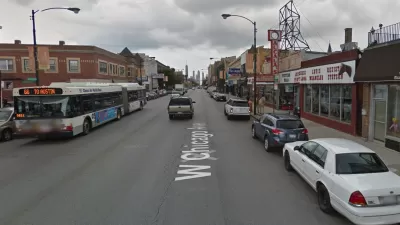
Opinion: Chicago Needs an Office of Parking Management
The city of Chicago needs a local agency empowered to planning, studying, or managing parking, according to a recent opinion piece published by Streetsblog Chicago.

Motorists Sue Chicago Parking Meter Operator
A lawsuit claims a company's 75-year contract to manage the city of Chicago's parking meters amounts to an "unreasonable" monopoly.

Trump Administration Could Effectively End Housing Voucher Program
Federal officials are eyeing major cuts to the Section 8 program that helps millions of low-income households pay rent.

Planetizen Federal Action Tracker
A weekly monitor of how Trump’s orders and actions are impacting planners and planning in America.

Canada vs. Kamala: Whose Liberal Housing Platform Comes Out on Top?
As Canada votes for a new Prime Minister, what can America learn from the leading liberal candidate of its neighbor to the north?

Washington State’s Parking Reform Law Could Unlock ‘Countless’ Acres for New Housing
A law that limits how much parking cities can require for residential amd commercial developments could lead to a construction boom.

Wildlife Rebounds After the Eaton Fire
Following the devastation of the Eaton Fire, the return of wildlife and the regrowth of native plants are offering powerful signs of resilience and renewal.

LA to Replace Inglewood Light Rail Project With Bus Shuttles
LA Metro says the change is in response to community engagement and that the new design will be ready before the 2028 Olympic Games.
Urban Design for Planners 1: Software Tools
This six-course series explores essential urban design concepts using open source software and equips planners with the tools they need to participate fully in the urban design process.
Planning for Universal Design
Learn the tools for implementing Universal Design in planning regulations.
Central Transportation Planning Staff/Boston Region MPO
Heyer Gruel & Associates PA
Institute for Housing and Urban Development Studies (IHS)
City of Grandview
Harvard GSD Executive Education
Regional Transportation Commission of Southern Nevada
Toledo-Lucas County Plan Commissions