


Interstate speed limits can have an impact beyond their own lanes.
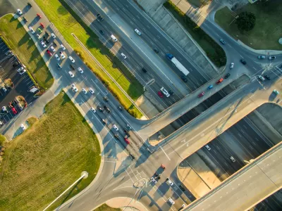
A new study reveals that increased speed limits on interstate freeways have a rippling effect, raising the number of speeding-related crashes in adjacent neighborhoods.
As Kea Wilson explains in Streetsblog USA, “In an analysis of three U.S. highway segments whose maximum speeds were increased at some point in the last decade — I-85 in Georgia, I-84 in Oregon and I-75 and I-69 in Michigan — researchers found that all reported significant new "clusters" of speeding-related crashes within a one-mile radius of the interstate.”
The findings belie the popular belief that interstate speeds don’t affect people traveling on other roads — including pedestrians and cyclists who never enter freeways. According to Dr. C.Y. David Yang, president and executive director of the AAA Foundation for Traffic Safety, “similarly to the ‘distraction hangover’ that drivers experience even after they stop using a cell phone behind the wheel, motorists don't immediately register just how quickly they need to slow down after they exit the interstate — especially when local roads themselves are designed like highways where it's perfectly fine to go fast.”
Wilson points out that interstate routes and speed limits are controlled at the state level, giving local communities little say in the process. “While Yang stops short of saying that speed limits should never be raised on the highway, he says it's critical that stakeholders like state, county, and city departments of transportation communicate in advance of those increases, so the locals can take action to slow drivers down, like modifying road designs.”
FULL STORY: Study: When Speed Limits Rise on Interstates, So Do Crash Hot Spots on Nearby Roads

California Bill Would Require Speed Governors on Cars
The legislation would call for speed-limiting technology on cars made and sold in the state that would keep speeds to no more than 10 miles over the posted speed limit.
How Understanding Near-Misses Can Improve Road Safety
Most road safety efforts are based on data about crashes that have already occurred. But important information can be gleaned from incidents when something almost went wrong, but didn’t.
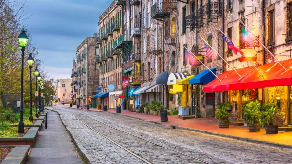
Savannah Reduces Speed Limits on Almost 100 City Streets
The historic Georgia city is lowering speed limits in an effort to reduce road fatalities.

Planetizen Federal Action Tracker
A weekly monitor of how Trump’s orders and actions are impacting planners and planning in America.

Maui's Vacation Rental Debate Turns Ugly
Verbal attacks, misinformation campaigns and fistfights plague a high-stakes debate to convert thousands of vacation rentals into long-term housing.

Restaurant Patios Were a Pandemic Win — Why Were They so Hard to Keep?
Social distancing requirements and changes in travel patterns prompted cities to pilot new uses for street and sidewalk space. Then it got complicated.

In California Battle of Housing vs. Environment, Housing Just Won
A new state law significantly limits the power of CEQA, an environmental review law that served as a powerful tool for blocking new development.

Boulder Eliminates Parking Minimums Citywide
Officials estimate the cost of building a single underground parking space at up to $100,000.

Orange County, Florida Adopts Largest US “Sprawl Repair” Code
The ‘Orange Code’ seeks to rectify decades of sprawl-inducing, car-oriented development.
Urban Design for Planners 1: Software Tools
This six-course series explores essential urban design concepts using open source software and equips planners with the tools they need to participate fully in the urban design process.
Planning for Universal Design
Learn the tools for implementing Universal Design in planning regulations.
Heyer Gruel & Associates PA
JM Goldson LLC
Custer County Colorado
City of Camden Redevelopment Agency
City of Astoria
Transportation Research & Education Center (TREC) at Portland State University
Jefferson Parish Government
Camden Redevelopment Agency
City of Claremont