


The infamously car-centric city is weighing a proposed congestion pricing pilot program to reduce traffic and encourage public transit use.
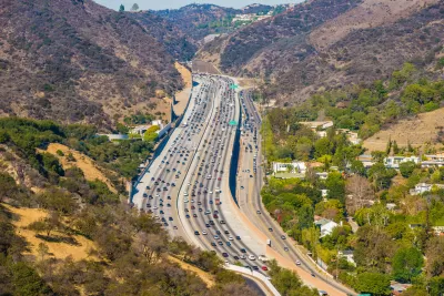
L.A.’s notoriously traffic-choked freeways may soon not be so free anymore, reports Rachel Uranga for the Los Angeles Times. The Los Angeles County Metropolitan Transportation Authority (Metro), the region’s transit agency, is exploring a congestion pricing scheme for some of the city’s freeways and roads.
The plan so far lacks solid details, but Metro expects to release a full study of the potential program in the next few months. “The transit agency has zeroed in on three locations for a possible test program: a nearly 16-mile stretch of the 10 Freeway between downtown and Santa Monica, arterial streets and freeways around downtown and the canyon streets and freeways that connect the San Fernando Valley to the L.A. Basin.”
According to Uranga, “the plan promises cleaner air, smoother rides and more funds to the agency’s coffers in the future. Studies show it could reduce harmful air pollution and greenhouse gas emissions by pushing more commuters to use public transit, while making roads less hellish for those who pay to use them.”
Rather than having optional paid lanes, which already exist in the Los Angeles area, the congestion pricing proposal would apply to entire roadways. “The aim is to change commuter behavior with the charges while providing transit alternatives.” Those transit alternatives, which remain an inferior option in most parts of the city, will be key to getting commuters to switch modes.
On the other coast, New York City’s congestion pricing plan is inching forward. If implemented, it would be the first such plan in the country.
FULL STORY: The freeway was born in L.A. But it might not always be free to drive on


NYC Congestion Pricing Continues to Show Positive Results
While the Trump administration attempts to revoke the program’s federal approval, congestion pricing continues to reduce traffic, speed up bus travel times, and improve air quality in Manhattan.
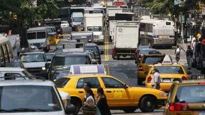
NYC Congestion Pricing Plan Gains Federal Approval
The program would be the first cordon pricing scheme in the United States.
Debating L.A.'s Growth, Traffic and Transit
The Transit Coalition's Bart Reed and USC planning Professor Peter Gordon debate transit and traffic in L.A. in this five-part point-counterpoint series.

Maui's Vacation Rental Debate Turns Ugly
Verbal attacks, misinformation campaigns and fistfights plague a high-stakes debate to convert thousands of vacation rentals into long-term housing.

Planetizen Federal Action Tracker
A weekly monitor of how Trump’s orders and actions are impacting planners and planning in America.

In Urban Planning, AI Prompting Could be the New Design Thinking
Creativity has long been key to great urban design. What if we see AI as our new creative partner?

King County Supportive Housing Program Offers Hope for Unhoused Residents
The county is taking a ‘Housing First’ approach that prioritizes getting people into housing, then offering wraparound supportive services.

Researchers Use AI to Get Clearer Picture of US Housing
Analysts are using artificial intelligence to supercharge their research by allowing them to comb through data faster. Though these AI tools can be error prone, they save time and housing researchers are optimistic about the future.

Making Shared Micromobility More Inclusive
Cities and shared mobility system operators can do more to include people with disabilities in planning and operations, per a new report.
Urban Design for Planners 1: Software Tools
This six-course series explores essential urban design concepts using open source software and equips planners with the tools they need to participate fully in the urban design process.
Planning for Universal Design
Learn the tools for implementing Universal Design in planning regulations.
planning NEXT
Appalachian Highlands Housing Partners
Mpact (founded as Rail~Volution)
City of Camden Redevelopment Agency
City of Astoria
City of Portland
City of Laramie