


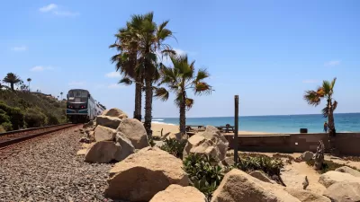
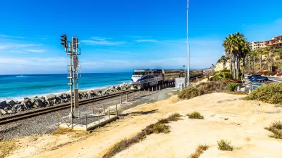
A scenic Southern California line could require relocation as rising sea levels destabilize the coastal soil that supports its tracks.
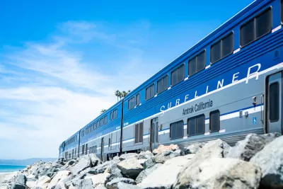
California’s most scenic train trip faces an uncertain future as rising sea levels threaten the ground beneath its tracks, forcing Amtrak and the regional Metrolink agency to evaluate how to stabilize the faltering coastline and protect the tracks. Allison Nicole Smith reports on the story for Bloomberg CityLab.
On September 30, Amtrak and Metrolink stopped service on a stretch of rail south of Los Angeles due to safety concerns. “After Tropical Storm Kay tore into the Golden State’s seaboard with heavy rains and high tides, geotechnical sensors detected that the fragile landscape of sand and rock underneath the tracks near San Clemente was moving as much as nearly a half an inch a day.” The same segment was shut down last September for three weeks.
Officials secured $6 million to stabilize the tracks. “The plan is to drive large metal anchors into the adjacent slope to prevent it from pushing the track further toward the coast, according to a news release.” The San Diego Association of Governments (SANDAG) has developed a plan to move the tracks into an inland tunnel at a cost of over $2.5 billion. Other alternatives include building seawalls or other coastal barriers.
The long-term future of the line—and coastal development in general—remains unclear as climate change speeds up coastal erosion in California, where 44 percent of residents live along the coast.
FULL STORY: The Race to Save a Scenic California Train From Rising Seas

State Leaders Warn of Risks to Southern California Rail Corridor
Coastal erosion and rising sea levels threaten one of the nation’s most scenic—and strategically important—rail corridors.

SoCal Leaders Debate Moving Coastal Rail Line
Train tracks running along the Pacific Ocean are in danger from sea level rise, but residents are divided on how to fix the problem.
Storms Sever California Rail Line—Again
The coast-hugging rail corridor linking Los Angeles and San Diego faces an uncertain future as mudslides once again force part of the line to close.

Montreal Mall to Become 6,000 Housing Units
Place Versailles will be transformed into a mixed-use complex over the next 25 years.

Planetizen Federal Action Tracker
A weekly monitor of how Trump’s orders and actions are impacting planners and planning in America.

DARTSpace Platform Streamlines Dallas TOD Application Process
The Dallas transit agency hopes a shorter permitting timeline will boost transit-oriented development around rail stations.

Interactive Map Reveals America's “Shade Deserts”
Launched by UCLA and American Forests to combat heat-related deaths, the tool maps the shade infrastructure for over 360 U.S. cities.

Bicycles and Books — In Sacramento, Libraries Now Offer Both
Adult library card holders can check out e-bikes and e-trikes for up to one week.

Colorado Landfills Emit as Much Pollution as 1M Cars
Landfills are the third-largest source of methane pollution in Colorado, after agriculture and fossil fuel extraction.
Urban Design for Planners 1: Software Tools
This six-course series explores essential urban design concepts using open source software and equips planners with the tools they need to participate fully in the urban design process.
Planning for Universal Design
Learn the tools for implementing Universal Design in planning regulations.
City of Mt Shasta
City of Camden Redevelopment Agency
City of Astoria
Transportation Research & Education Center (TREC) at Portland State University
City of Camden Redevelopment Agency
Municipality of Princeton (NJ)
Regional Transportation Commission of Southern Nevada