A nine-month bus rapid transit planning process, one of the key components of the Cincinnati region’s “Reinventing Metro” long-range transit plan, launched recently.


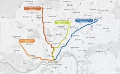
Cincinnati has launched a planning process for bus rapid transit (BRT) additions to its public transit system as part of the Reinventing Metro plan approved by Hamilton County voters in 2020.
According to the Reinventing Metro website, the BRT planning is underway as a collaboration between Cincinnati’s Metro and the Southwest Ohio Regional Transit Authority (SORTA). A nine-month study will narrow down the choices along four corridors identified by Reinventing Metro as the most popular transit corridors in the Metro system: Glenway Avenue, Hamilton Avenue, Reading Road, and Montgomery Road.
Chris Wetterich reports on the bus rapid transit plans in a paywalled article for the Cincinnati Business Courier. In 2021, the Cincinnati Business Courier identified bus rapid transit [paywall] as one of the most critical infrastructure projects for the region.
Public transit has faced challenges in Cincinnati in recent years, so successful planning of BRT routes would go a long way to instilling public faith in transit in the region. Despite voters approving the sales tax necessary to support Reinventing Metro, the Cincinnati Bell Connector streetcar has been dogged by political opposition, management crises, and low ridership from its inception.
Read the full story: Cincinnati Metro to vet where to build bus rapid transit lines


Transit Improvements Coming to Cincinnati Area After Voters Approve New Sales Tax
Hamilton County, Ohio, home to Cincinnati and the Southwest Ohio Regional Transit Authority, has a new coffer of money to fund public transit improvements.
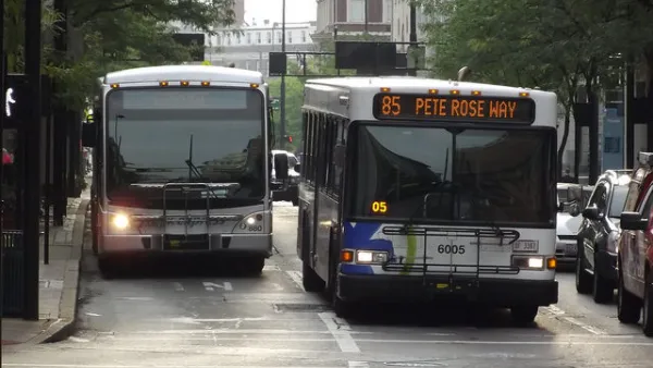
400 Stops Removed From the Cincinnati Metro Bus System
The process of reducing the number of stops on a transit line—known as bus stop thinning, consolidation, or balancing—took effect this week in Cincinnati. Reducing the number of stops is intended to speed up buses and improve reliability.
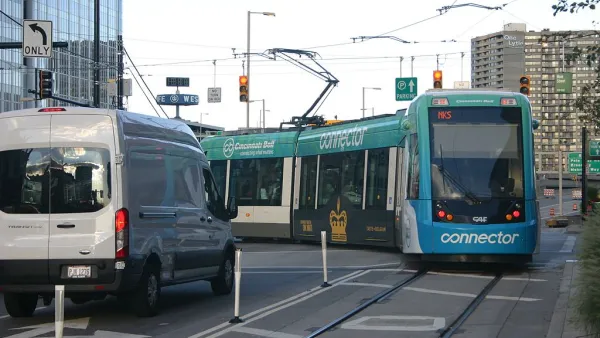
Management Divorce for the Cincinnati Streetcar
Efforts to bolster support for a countywide sales tax levy in Hamilton County, Ohio, are pushing the city to fire SORTA as the manager of the troubled Cincinnati Bell Connector.

Planetizen Federal Action Tracker
A weekly monitor of how Trump’s orders and actions are impacting planners and planning in America.

California plans to bury El Niño’s downpour
If the state plays its cards right, it may be able to store a billion acre-feet of El Niño’s water in aquifers.

Desperate measures: Advocates weigh draining Lake Powell to fill Colorado River
Draining the reservoir could reduce evaporation losses by a couple hundred thousand acre-feet.

California city breaks ground on transit connector
The project includes three mobility hubs and a pedestrian bridge.

After public outcry, Massachusetts city releases housing development tracker
Cambridge’s tracker currently shows 250 housing projects in various stages of development.

40 years after approval, Chicago breaks ground on new park
The park honors Jean Baptiste Point du Sable, the city’s first permanent non-native settler.

FREE Course: Walkable City 1: Why Walkability?
After describing his path towards focusing on walkability as the essence of good planning, Jeff Speck marches through his five principal reasons for making more walkable places.
Reinventing Malls: Planning Alchemy—Turning Gray Fields Into Gold
The course focuses on the opportunities and imperatives that shape reinvention of mall sites.

City of Rosemead
Rutgers University, Edward J. Bloustein School of Planning and Public Policy
One Hundred Miles
Hunter College, City University of New York (CUNY)
The Architects Foundation
University of Cincinnati Online
City of Cambridge
Montrose County
The Pocatello Development Authority