


A new study evaluates county-level foreclosure risk, underwater home values, and more real estate market data after two years of the Covid-19 pandemic in the United States.

New analysis by real estate data firm Attom Data Solutions ranks the most-at-risk real estate markets in the United States.
"New Jersey, Illinois and parts of California had the highest concentrations of the most at-risk markets in the fourth quarter – with the biggest clusters still in the New York City and Chicago areas," according to a press release announcing the fourth-quarter 2021 Special Coronavirus Report by Attom Data Solutions.
"New Jersey, Illinois and California had 31 of the 50 counties most vulnerable to the potential economic impact of the pandemic," adds the press release. "The 50 most at-risk included eight counties in the Chicago metropolitan area, eight near New York City and seven sprinkled through northern, central and southern California."
The report uses home affordability, equity and foreclosure reports data prepared by ATTOM, and calculates risk based on the percentage of homes facing possible foreclosure, the portion with mortgage balances that exceeded estimated property values and the percentage of average local wages required to pay for major home ownership expenses on median-priced single-family homes.
An article by Alexandre Tanzi for Bloomberg Wealth provides news coverage of the report.
FULL STORY: Housing Markets At Risk From Pandemic Downturns Concentrated In New Jersey, Illinois And California

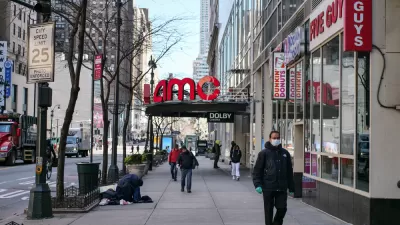
Chain Retail Slow to Recover From Pandemic in New York City
2020 was a rough year for retail chains in New York City, making even a slow year, like 2021, look like a recovery.

More Insight Into the Effects of the Pandemic for Rental Property Landlords
A pair of recent surveys attempt to shed light on the changing business and property management practices of landlords during the pandemic.

Emergency Rental Relief Gaining Momentum in Some States
Rental assistance spending in June surpassed the entire year's total so far, but there's still a long way to go.

Montreal Mall to Become 6,000 Housing Units
Place Versailles will be transformed into a mixed-use complex over the next 25 years.

Planetizen Federal Action Tracker
A weekly monitor of how Trump’s orders and actions are impacting planners and planning in America.

DARTSpace Platform Streamlines Dallas TOD Application Process
The Dallas transit agency hopes a shorter permitting timeline will boost transit-oriented development around rail stations.

Interactive Map Reveals America's “Shade Deserts”
Launched by UCLA and American Forests to combat heat-related deaths, the tool maps the shade infrastructure for over 360 U.S. cities.

Bicycles and Books — In Sacramento, Libraries Now Offer Both
Adult library card holders can check out e-bikes and e-trikes for up to one week.

Colorado Landfills Emit as Much Pollution as 1M Cars
Landfills are the third-largest source of methane pollution in Colorado, after agriculture and fossil fuel extraction.
Urban Design for Planners 1: Software Tools
This six-course series explores essential urban design concepts using open source software and equips planners with the tools they need to participate fully in the urban design process.
Planning for Universal Design
Learn the tools for implementing Universal Design in planning regulations.
City of Mt Shasta
City of Camden Redevelopment Agency
City of Astoria
Transportation Research & Education Center (TREC) at Portland State University
US High Speed Rail Association
City of Camden Redevelopment Agency
Municipality of Princeton (NJ)