


New mapping tools are helping cities around the world map and understand their poorest communities.
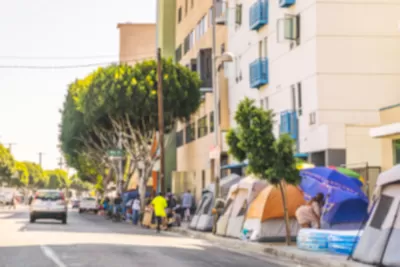
"The geography of slum living has long been poorly defined," writes Laura Bliss, but an international NGO hopes to change that by facilitating the mapping of informal neighborhoods in cities around the world. According to Tony Frangie, "It’s no secret that census officials don’t really go deep into these areas, so nobody really knows the real population of the entire city." And "[w]ith no street names or buildings on platforms such as Google Maps, information gaps keep much of the slum landscape hidden to outsiders. For residents, it makes it harder to access the benefits and services of urban development, such as roads, water hookups, sanitation and the internet. "
The ability to create maps of formerly ignored areas can have immediate impacts on people's access to services. Map Kibera, a project in Kenya, "has shown by providing geographic information to NGOs and activists that have successfully improved water connections and the number of schools in slums outside Nairobi."
"In Caracas, a group of researchers and students recorded the streets and businesses of the San Miguel de la Vega slum using notebooks and smartphones, then uploaded the information to OpenStreetMap, the open-source mapping platform" to create a map of the neighborhood. "Humanitarian OpenStreetMap Team (HOT), an international NGO dedicated to open-source mapping for development and humanitarian purposes, has helped dozens of similar projects around the world."
FULL STORY: MapLab: Putting Slums on the Map

Mapping Needed to Improve Slums
Understanding and improving the Brazilian informal settlements known as favelas will require more information about the slums -- especially in the field of mapping.

Trump Cuts Decimate Mapping Agency
The National Geodetic Survey maintains and updates critical spatial reference systems used extensively in both the public and private sectors.

New Book Shows How Geographic Technology Tackles Global Challenges
In his new book, Jack Dangermond explores the transformative impact of GIS technology in solving global challenges through spatial data, highlighting its widespread application across sectors and its potential to design sustainable futures.

Planetizen Federal Action Tracker
A weekly monitor of how Trump’s orders and actions are impacting planners and planning in America.

Congressman Proposes Bill to Rename DC Metro “Trump Train”
The Make Autorail Great Again Act would withhold federal funding to the system until the Washington Metropolitan Area Transit Authority (WMATA), rebrands as the Washington Metropolitan Authority for Greater Access (WMAGA).

The Simple Legislative Tool Transforming Vacant Downtowns
In California, Michigan and Georgia, an easy win is bringing dollars — and delight — back to city centers.

The States Losing Rural Delivery Rooms at an Alarming Pace
In some states, as few as 9% of rural hospitals still deliver babies. As a result, rising pre-term births, no adequate pre-term care and "harrowing" close calls are a growing reality.

The Small South Asian Republic Going all in on EVs
Thanks to one simple policy change less than five years ago, 65% of new cars in this Himalayan country are now electric.

DC Backpedals on Bike Lane Protection, Swaps Barriers for Paint
Citing aesthetic concerns, the city is removing the concrete barriers and flexposts that once separated Arizona Avenue cyclists from motor vehicles.
Urban Design for Planners 1: Software Tools
This six-course series explores essential urban design concepts using open source software and equips planners with the tools they need to participate fully in the urban design process.
Planning for Universal Design
Learn the tools for implementing Universal Design in planning regulations.
Smith Gee Studio
City of Charlotte
City of Camden Redevelopment Agency
City of Astoria
Transportation Research & Education Center (TREC) at Portland State University
US High Speed Rail Association
City of Camden Redevelopment Agency
Municipality of Princeton (NJ)