


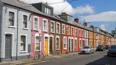
Cities are beginning to recognize that effective curb management is an important part of reducing congestion and ensuring equitable use of public space.

The humble curb is becoming a hot commodity as cities scramble to regulate curbside parking and curb usage in the wake of new services and technologies that have made on-demand pickups, deliveries, and micro-mobility options more popular than ever. Writing for Governing, Skip Descant reports on nationwide efforts to regulate curb use and manage congestion.
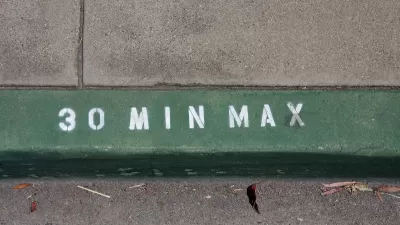
The city of Aspen, Colorado has established "smart zones" that drivers can book for quick deliveries, creating "a smoother orchestration of goods coming into the city’s small downtown." A Las Vegas project monitors curbside parking and alerts drivers and the city when a vehicle exceeds parking limits. "As these types of projects become more common, data sharing and data standards — like Mobility Data Specifications (MDS) — are needed to better manage public right-of-way spaces, said Regina Clewlow, CEO and founder of Populus."
Curb management initiatives and the "adoption of new digital tools" can help cities keep up with new mobility technologies and manage public space effectively and sustainably, said Clewlow. "Without data, many cities were essentially blind to how their streets, curbs and sidewalks were being used by new fleet services. With data, they’re now empowered to create policies, and more quickly establish new infrastructure that’s cleaner, that’s safer, and that’s more equitable."
FULL STORY: Cities Focus on Urban Curbs and How to Manage Them

Reimagining the Curb: How Smart Curb Management is Transforming Urban Mobility
Modern demands for curbside space call for new ways to manage and allocate it.

State of Curbs & Parking Report Reveals Glut of Data
As the uses of curb space become more diverse, city officials are working to understand how to best manage this increasingly important urban amenity.
How Cities Use Tech for Curb Management
Curb monitoring technology is helping cities build a growing understanding of the shifting demand for this valuable urban space.

Maui's Vacation Rental Debate Turns Ugly
Verbal attacks, misinformation campaigns and fistfights plague a high-stakes debate to convert thousands of vacation rentals into long-term housing.

Planetizen Federal Action Tracker
A weekly monitor of how Trump’s orders and actions are impacting planners and planning in America.

In Urban Planning, AI Prompting Could be the New Design Thinking
Creativity has long been key to great urban design. What if we see AI as our new creative partner?

Baker Creek Pavilion: Blending Nature and Architecture in Knoxville
Knoxville’s urban wilderness planning initiative unveils the "Baker Creek Pavilion" to increase the city's access to green spaces.

Pedestrian Deaths Drop, Remain Twice as High as in 2009
Fatalities declined by 4 percent in 2024, but the U.S. is still nowhere close to ‘Vision Zero.’

King County Supportive Housing Program Offers Hope for Unhoused Residents
The county is taking a ‘Housing First’ approach that prioritizes getting people into housing, then offering wraparound supportive services.
Urban Design for Planners 1: Software Tools
This six-course series explores essential urban design concepts using open source software and equips planners with the tools they need to participate fully in the urban design process.
Planning for Universal Design
Learn the tools for implementing Universal Design in planning regulations.
planning NEXT
Appalachian Highlands Housing Partners
Mpact (founded as Rail~Volution)
City of Camden Redevelopment Agency
City of Astoria
City of Portland
City of Laramie