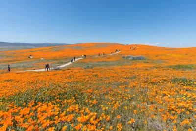
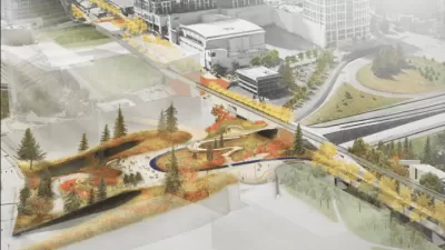
The Los Angeles County Department of Parks and Recreation is doing a study to inventory and analyze the need for facilities like beaches, natural areas, open space, regional parks, trails, and local parks in rural areas.

What is the need for recreational assets like regional parks, beaches and trails in a county with over ten million residents? What are the potential opportunities to expand existing parklands and acquire additional land for recreation and conservation purposes? What are the unique park and recreation needs of rural areas and how do we best address them? In this article, park planner Clement Lau reports that the Los Angeles County Department of Parks and Recreation (DPR) is starting a community engagement and outreach process to help answer these questions and more. As a focused update to the 2016 Los Angeles Countywide Parks Needs Assessment, this effort is called the "Regional and Rural Edition." Specifically, the study will apply an equity lens to comprehensively identify, analyze, map, and document:
- The need for regional facilities, including regional parks, beaches and lakes, trails, and natural areas and open spaces
- The park needs of rural communities which are primarily located in the Antelope Valley, Santa Clarita Valley, and Santa Monica Mountains
Designed to be extensive and inclusive, the community engagement and outreach process is being launched this month in partnership with county departments, community-based organizations, and other groups. Due to COVID-19-related health restrictions on in-person meetings and group gatherings, the process will consist primarily of online engagement and physically distanced activities, including the following:
- Project website updates
- Surveys/polls using tools like Maptionnaire
- Social media, including platforms such as Instagram, Facebook, and Twitter
- Stakeholder interviews
- Phone calls
- Focus groups
- Workshops
- Webinars
DPR has also convened a Technical Advisory Committee (TAC) to help inform and guide the process of data collection and analysis, development of metrics, community engagement and outreach, and other key aspects of the project. The TAC includes representatives from a broad range of agencies and organizations with expertise in beaches, parks, public health, regional planning, transportation, open space and conservation, sustainability, and geographic information systems (GIS).
DPR is the lead agency charged with updates and implementation of the Countywide Parks Needs Assessment. The 2016 Parks Needs Assessment involved a 14-month process that included data collection and analysis, engagement with stakeholders and community members in cities and unincorporated areas, prioritization and cost estimation of prioritized park projects, and the determination of park need in each study area based on a suite of metrics. The Parks Needs Assessment directly informed the development of Measure A, a countywide funding measure for parks approved by nearly 75 percent of L.A. County voters in November 2016 and generates more than $90 million annually.
FULL STORY: Conducting a Regional and Rural Parks Needs Assessment

Planetizen Federal Action Tracker
A weekly monitor of how Trump’s orders and actions are impacting planners and planning in America.

Congressman Proposes Bill to Rename DC Metro “Trump Train”
The Make Autorail Great Again Act would withhold federal funding to the system until the Washington Metropolitan Area Transit Authority (WMATA), rebrands as the Washington Metropolitan Authority for Greater Access (WMAGA).

DARTSpace Platform Streamlines Dallas TOD Application Process
The Dallas transit agency hopes a shorter permitting timeline will boost transit-oriented development around rail stations.

Renters Now Outnumber Homeowners in Over 200 US Suburbs
High housing costs in city centers and the new-found flexibility offered by remote work are pushing more renters to suburban areas.

The Tiny, Adorable $7,000 Car Turning Japan Onto EVs
The single seat Mibot charges from a regular plug as quickly as an iPad, and is about half the price of an average EV.

Supreme Court Ruling in Pipeline Case Guts Federal Environmental Law
The decision limits the scope of a federal law that mandates extensive environmental impact reviews of energy, infrastructure, and transportation projects.
Urban Design for Planners 1: Software Tools
This six-course series explores essential urban design concepts using open source software and equips planners with the tools they need to participate fully in the urban design process.
Planning for Universal Design
Learn the tools for implementing Universal Design in planning regulations.
Municipality of Princeton
Roanoke Valley-Alleghany Regional Commission
City of Mt Shasta
City of Camden Redevelopment Agency
City of Astoria
Transportation Research & Education Center (TREC) at Portland State University
US High Speed Rail Association
City of Camden Redevelopment Agency
Municipality of Princeton (NJ)


