


University of Hawaii graduate students explored the potential for improvements to the Ala Wai Small Boat Harbor, an important coastal public space in Honolulu.
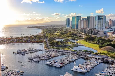
Coastal planning is complicated and challenging even for seasoned planners due in part to the variety of issues and stakeholders involved. But that has not discouraged planning and landscape architecture students from the University of Hawaii at Manoa from studying Ala Wai Small Boat Harbor and offering recommendations for its improvement. Specifically, students in two graduate classes recently explored the potential for short- and long-term improvements to the harbor which is an important coastal public space that serves as a link between Ala Moana and Waikīkī.
The students in a planning practicum and a landscape architecture studio also examined how projected sea-level rise would impact the harbor. They conducted research, gathered input from stakeholders, studied precedents, and explored design strategies to tackle the issue. The findings informed their conceptual plan and recommendations for climate risk adaptation as well as for site improvements to enhance this public amenity. The students appreciated the opportunity to work on a real-world assignment to assist the state’s Division of Boating and Ocean Recreation and gain valuable experience and skills to prepare them for the transition to becoming professionals.
Ala Wai Harbor is the largest small boat and yacht harbor in Hawaii. The harbor is situated in Honolulu at the mouth of the Ala Wai Canal, between Waikiki and downtown Honolulu. To the east are Waikiki and Diamond Head; to the west are Magic Island and the Honolulu waterfront. Ala Wai Harbor has a rich cultural history and land uses that support recreational activities. Research shows that the harbor will be impacted by sea-level rise in the coming years. Thus, it is critical for any future plans to address this issue while taking into consideration the public’s vision for the harbor.
FULL STORY: Ala Wai Harbor gets planning help from UH students

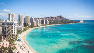
Study: Oahu Could Lose 40 Percent of its Beaches by 2050
A new study calls for changes to coastal management policies to better protect sandy shorelines retreating under the pressure of rising sea levels.
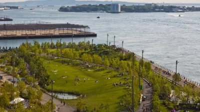
New York Updating its Comprehensive Waterfront Plan
Vision 2030 will update the award winning Vision 2020 New York City Comprehensive Waterfront Plan.
Coronavirus Success: The Unusual Story Behind the State with the Lowest Infection Rate
Like New Zealand, another island has achieved success in reducing viral spread. The ability to quarantine travelers to Hawaii was crucial, but the virus had already arrived. Health professionals played key roles which, at times, led to conflict.

Planetizen Federal Action Tracker
A weekly monitor of how Trump’s orders and actions are impacting planners and planning in America.

The Simple Legislative Tool Transforming Vacant Downtowns
In California, Michigan and Georgia, an easy win is bringing dollars — and delight — back to city centers.

San Francisco's School District Spent $105M To Build Affordable Housing for Teachers — And That's Just the Beginning
SFUSD joins a growing list of school districts using their land holdings to address housing affordability challenges faced by their own employees.

In More Metros Than You’d Think, Suburbs are Now More Expensive Than the City
If you're moving to the burbs to save on square footage, data shows you should think again.

The States Losing Rural Delivery Rooms at an Alarming Pace
In some states, as few as 9% of rural hospitals still deliver babies. As a result, rising pre-term births, no adequate pre-term care and "harrowing" close calls are a growing reality.

The Small South Asian Republic Going all in on EVs
Thanks to one simple policy change less than five years ago, 65% of new cars in this Himalayan country are now electric.
Urban Design for Planners 1: Software Tools
This six-course series explores essential urban design concepts using open source software and equips planners with the tools they need to participate fully in the urban design process.
Planning for Universal Design
Learn the tools for implementing Universal Design in planning regulations.
Smith Gee Studio
City of Charlotte
City of Camden Redevelopment Agency
City of Astoria
Transportation Research & Education Center (TREC) at Portland State University
US High Speed Rail Association
City of Camden Redevelopment Agency
Municipality of Princeton (NJ)