


A thorough and damning indictment of 20th century land use and infrastructure planning, and its contemporary legacy of segregation and congestion.
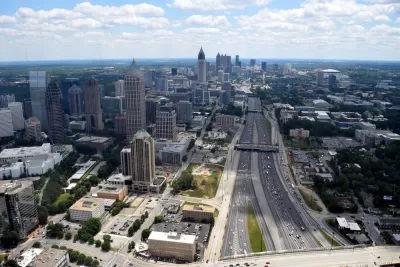
Kevin M. Kruse starts a big feature on the segregationist purposes of 20th century urban freeway planning by noting the terrible traffic conditions in Atlanta. The traffic is a result of the deliberate design of a system meant to segregate white populations from black, according to Kruse.
"In Atlanta, as in dozens of cities across America, daily congestion is a direct consequence of a century-long effort to segregate the races."
While the federal government paid for most of the creation of the Interstate highway system during the 1950s and 1960s, local officials had a lot of power in determining the path of urban freeways.
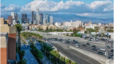
"As in most American cities in the decades after the Second World War, the new highways in Atlanta — local expressways at first, then Interstates — were steered along routes that bulldozed 'blighted' neighborhoods that housed its poorest residents, almost always racial minorities," according to Kruse. The story is repeated in other cities like Jacksonville, Miami, Nashville, New Orleans, Richmond, and Tampa, but also other cities around the country, like Chicago, Cincinnati, Denver, Detroit, Indianapolis, Los Angeles, Milwaukee, Pittsburgh, St. Louis, Syracuse, and Washington.
Interstates were a tool of urban renewal, destroying black and low-income neighborhoods, but also as a toll of segregation. Kruse explains:
"Today, major roads and highways serve as stark dividing lines between black and white sections in cities like Buffalo, Hartford, Kansas City, Milwaukee, Pittsburgh and St. Louis. In Atlanta, the intent to segregate was crystal clear. Interstate 20, the east-west corridor that connects with I-75 and I-85 in Atlanta’s center, was deliberately plotted along a winding route in the late 1950s to serve, in the words of Mayor Bill Hartsfield, as “the boundary between the white and Negro communities” on the west side of town."
The story told by Kruse continues, with worsening congestion in the Atlanta region and the obstinate opposition of white suburban neighborhoods to public transit. That part of story continues to this day, as Gwinnett County voted MARTA funding down yet again earlier this year.
FULL STORY: What does a traffic jam in Atlanta have to do with segregation? Quite a lot.


The Foundational Myth of America's Interstate Highway System
The erroneous belief that the negative impacts of interstate highways are simply "unintended consequences" fails to demand accountability for the project's failures.
When Discussing Racist Monuments, Don't Forget Urban Freeways
The racist history of planning in Los Angeles is particularly evident in the way Interstate freeways were planned in the region.
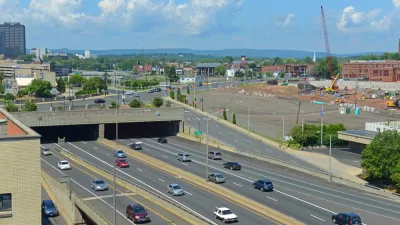
Undoing the Destructive Legacy of Hartford's Interstates
A new plan would spend an estimated $17 billion to remove a huge chunk of the Interstate Highway System's footprint in Hartford, Connecticut.

Montreal Mall to Become 6,000 Housing Units
Place Versailles will be transformed into a mixed-use complex over the next 25 years.

Planetizen Federal Action Tracker
A weekly monitor of how Trump’s orders and actions are impacting planners and planning in America.

DARTSpace Platform Streamlines Dallas TOD Application Process
The Dallas transit agency hopes a shorter permitting timeline will boost transit-oriented development around rail stations.

Study: 4% of Truckers Lack a Valid Commercial License
Over 56% of inspected trucks had other violations.

Chicago Judge Orders Thousands of Accessible Ped Signals
Only 3% of the city's crossing signals are currently accessible to blind pedestrians.

Philadelphia Swaps Car Lanes for Bikeways in Unanimous Vote
The project will transform one of the handful of streets responsible for 80% of the city’s major crashes.
Urban Design for Planners 1: Software Tools
This six-course series explores essential urban design concepts using open source software and equips planners with the tools they need to participate fully in the urban design process.
Planning for Universal Design
Learn the tools for implementing Universal Design in planning regulations.
City of Mt Shasta
City of Camden Redevelopment Agency
City of Astoria
Transportation Research & Education Center (TREC) at Portland State University
US High Speed Rail Association
City of Camden Redevelopment Agency
Municipality of Princeton (NJ)