


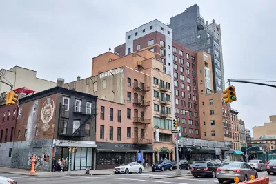
It's hard to connect zoning to planning and development outcomes at a national level because very little data exists at that scale.
Graham MacDonald, Solomon Greene, and Emma Nechamkin put out a call for improved data on zoning to help address the nation's ongoing housing and development challenges.
Even though there has been some promising research on local zoning and land-use regulations, most has been hampered by a lack of data. How has zoning changed? What reforms were implemented and where? How have various reforms affected housing supply, affordability, and climate change? We either don’t know or know very little because data are out of date, incomplete, or do not exist.
The best existing data sources, according to the article, "consist of two surveys of local governments in the nation’s largest metropolitan areas dated 1994 and 2003, a regulatory index derived from a survey of local governments in 2007, and some recent papers that try to approximate zoning data using court decisions or construction costs (PDF)."
MacDonald, Greene, and Nechamkin are working at the Urban Institute to fill those gaps, promising to release several projects in the coming year. One fairly recent project, published in January, is already advancing the cause by assessing, "whether we can estimate density limits in local zoning codes using property assessment data."
FULL STORY: We need better zoning data to address pressing housing and development issues


Watch: Debunking Myths About Houston's Lack of Zoning
A video published last week by City Beautiful reveals the myths and misconceptions of Houston's land use regulation system.

Zoning Didn't Stand a Chance Against the Economy in New York's Garment District
Zoning can only be so effective in holding off market forces, according to this column. New York City seems to have finally learned this lesson in the Garment District, but will it inform decisions in other parts of the city?

What Zoning Can and Can't Do
The powers, and the limitations, of zooming are explained in a series of posts on Greater Greater Washington.

Planetizen Federal Action Tracker
A weekly monitor of how Trump’s orders and actions are impacting planners and planning in America.

San Francisco's School District Spent $105M To Build Affordable Housing for Teachers — And That's Just the Beginning
SFUSD joins a growing list of school districts using their land holdings to address housing affordability challenges faced by their own employees.

The Tiny, Adorable $7,000 Car Turning Japan Onto EVs
The single seat Mibot charges from a regular plug as quickly as an iPad, and is about half the price of an average EV.

With Protected Lanes, 460% More People Commute by Bike
For those needing more ammo, more data proving what we already knew is here.

In More Metros Than You’d Think, Suburbs are Now More Expensive Than the City
If you're moving to the burbs to save on square footage, data shows you should think again.

The States Losing Rural Delivery Rooms at an Alarming Pace
In some states, as few as 9% of rural hospitals still deliver babies. As a result, rising pre-term births, no adequate pre-term care and "harrowing" close calls are a growing reality.
Urban Design for Planners 1: Software Tools
This six-course series explores essential urban design concepts using open source software and equips planners with the tools they need to participate fully in the urban design process.
Planning for Universal Design
Learn the tools for implementing Universal Design in planning regulations.
Smith Gee Studio
City of Charlotte
City of Camden Redevelopment Agency
City of Astoria
Transportation Research & Education Center (TREC) at Portland State University
US High Speed Rail Association
City of Camden Redevelopment Agency
Municipality of Princeton (NJ)