Down to the level of individual census tracts, a team of researchers has developed national maps showing where upward mobility is probable, and where it isn't.


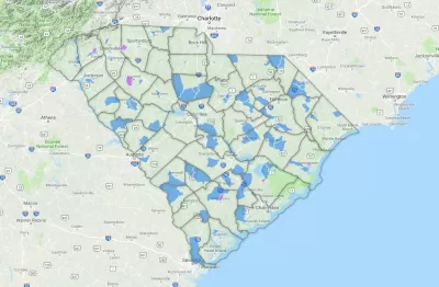
Hearkening back to demographic researcher Dustin Cable's Racial Dot Map, a team of researchers including Harvard's Raj Chetty have worked with the U.S. Census Bureau to assemble a compressive picture of which neighborhoods tend to foster children who get ahead, and which fail to do so.
The Opportunity Atlas, an interactive mapping tool, allows users to pinpoint specific census districts for comparison with the surrounding area, or zoom upward to see how counties and regions fare. According to reporting by Emily Badger and Quoctrung Bui, "for any government program or community grant that targets a specific place, this data proposes a better way to pick those places — one based not on neighborhood poverty levels, but on whether we expect children will escape poverty as adults."
The researchers, who in addition to Chetty include Nathaniel Hendren at Harvard, John N. Friedman at Brown University, and Maggie R. Jones and Sonya R. Porter at the Census Bureau, "believe much of this variation is driven by the neighborhoods themselves, not by differences in what brings people to live in them. The more years children spend in a good neighborhood, the greater the benefits they receive."
The question is whether policymakers, planners, philanthropists, and a whole range of neighborhood stakeholders will be able to use more finely-tuned data on opportunity to change places where "the federal government has spent billions [...] over the years, funneling as much as $500 million into some individual census tracts since 1990."
FULL STORY: Detailed New National Maps Show How Neighborhoods Shape Children for Life


New Tool Puts Miami Development Opportunities on the Map
There's plenty of vacant or underutilized land to be found in Miami-Dade County, if you know where and how to look.
Detailed 2020 Census Data Coming in 2023
The data release was delayed in part so that the agency could implement a new privacy policy aimed at protecting the identities of respondents.

Census Delays Release of 2020 American Community Survey Data
Due to the challenges faced by data collectors during the pandemic, the Census Bureau will not be releasing 2020 ACS data in September as usual.

Planetizen Federal Action Tracker
A weekly monitor of how Trump’s orders and actions are impacting planners and planning in America.

The state-sanctioned urbicide of Austin
People don’t kill cities. Freeways do.

US to reduce Colorado River water deliveries to Mexico
A new Colorado Treaty amendment reduces Mexico’s Colorado River water allocation by 250,000 acre feet.

5 New England states march closer to 800 megawatt wind energy project
Securing federal approval for the project may be complicated under the Trump administration, which has historically been hostile towards domestic wind power.

Baltimore to break ground on $50 million Transit Priority Project
The project will bring faster bus trips, safer streets and better bike connections to Baltimore.

Airbnb launches $250 million 'last-dollar financing' housing accelerator, makes first investment in Austin
The company will put $6.4 million towards affordable housing development in Texas’ capital.

FREE Course: Walkable City 1: Why Walkability?
After describing his path towards focusing on walkability as the essence of good planning, Jeff Speck marches through his five principal reasons for making more walkable places.
Reinventing Malls: Planning Alchemy—Turning Gray Fields Into Gold
The course focuses on the opportunities and imperatives that shape reinvention of mall sites.

Eagle County Government
Harvard University Graduate School of Design
Nashville Planning Department
The Architects Foundation
University of Cincinnati Online
The Pocatello Development Authority
The Urban Renewal Agency of the City of Pocatello
Journal of the American Planning Association