


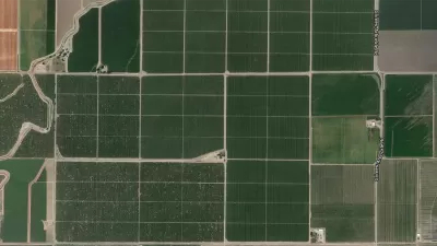
The New York Times published an interactive map that shows how important distance is in determining connections on social media.

New research published in the Journal of Economic Perspectives examines microdata from Facebook to ask questions about what social networks reveal about social connectedness between individuals and across regions.
Emily Badger and Quoctrong Bui share the news of the study, noting its findings about the importance of geographic distance in determining social connectedness.
"America is often described as a place of great divides — between red and blue, big cities and rural towns, the coasts and the heartland," they write. "But our social lives are shaped by a much stronger force that ignores many of these lines: distance."
The real fun of this article is found in an interactive map that illustrates the likelihood that people living in each U.S. county will have a Facebook friendship in any other part of the country. The article offers insight into some of the trends visible in the map.
FULL STORY: How Connected Is Your Community to Everywhere Else in America?


Friday Eye Candy: A Sorely-Needed Map of New York City Neighborhoods
Neighborhoods don't get the same official boundaries as cities, counties, states, and countries. So how do we know where one neighborhood ends and another begins?
Facebook AI Maps Population Density
Facebook expects to release its worldwide maps of human density in the coming months—potential applications will likely be somewhere on the spectrum between humanitarian and commercial.
Friday Eye Candy: The World's Subway Systems, If You Could See Them From Above
Have you ever flown over a city and imagined all the subway lines running beneath the surface?

Planetizen Federal Action Tracker
A weekly monitor of how Trump’s orders and actions are impacting planners and planning in America.

Congressman Proposes Bill to Rename DC Metro “Trump Train”
The Make Autorail Great Again Act would withhold federal funding to the system until the Washington Metropolitan Area Transit Authority (WMATA), rebrands as the Washington Metropolitan Authority for Greater Access (WMAGA).

DARTSpace Platform Streamlines Dallas TOD Application Process
The Dallas transit agency hopes a shorter permitting timeline will boost transit-oriented development around rail stations.

Renters Now Outnumber Homeowners in Over 200 US Suburbs
High housing costs in city centers and the new-found flexibility offered by remote work are pushing more renters to suburban areas.

The Tiny, Adorable $7,000 Car Turning Japan Onto EVs
The single seat Mibot charges from a regular plug as quickly as an iPad, and is about half the price of an average EV.

Supreme Court Ruling in Pipeline Case Guts Federal Environmental Law
The decision limits the scope of a federal law that mandates extensive environmental impact reviews of energy, infrastructure, and transportation projects.
Urban Design for Planners 1: Software Tools
This six-course series explores essential urban design concepts using open source software and equips planners with the tools they need to participate fully in the urban design process.
Planning for Universal Design
Learn the tools for implementing Universal Design in planning regulations.
Roanoke Valley-Alleghany Regional Commission
City of Mt Shasta
City of Camden Redevelopment Agency
City of Astoria
Transportation Research & Education Center (TREC) at Portland State University
US High Speed Rail Association
City of Camden Redevelopment Agency
Municipality of Princeton (NJ)