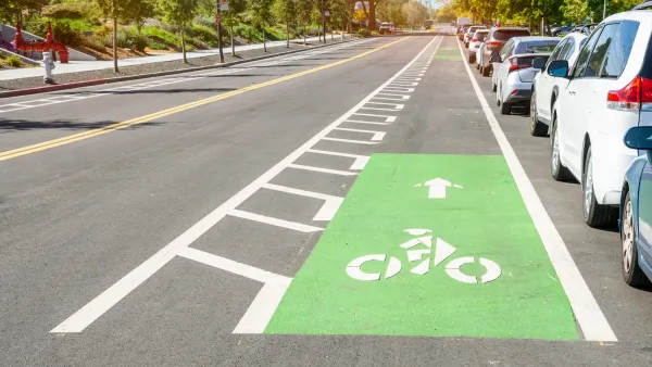
Users of the mobile travel planning app can now prioritize safe bike infrastructure when trip planning.



A new update to the Transit travel planning mobile app will let users prioritize safe bike routes, reports George Kevin Jordan in Streetsblog USA.
“Go Bike, from Montreal-based company Transit, now allows users to make biking their first mode of transit, shows safer bike routes first, and provides multiple bike route options.” The app is asking users to contribute information to ensure accurate data.
As Jordan explains, “Companies like Apple and Google have had hiccups and complaints about their navigation apps for cyclists, and while they have made improvements, there’s still a pathway for other competitors to create or improve their navigation services for users.”
For years, users struggled to find information about bike lanes, traffic lights, and safe routes using mapping apps. Now, “The app will display a route, and the percentage of bike lanes and paths on the journey, then orders them by safety first. So users will get directed to protected bike paths, then bike lanes, then residential streets, before the app offers up busy car-dominated roads.”
FULL STORY: Transit App Now Provides Safety-First Bike Directions


The 5 Safest Cities for Cyclists in America — and What They Have in Common
Cities with low fatality rates for people on bikes have made strong commitments to building safe, protected bike networks and supporting Complete Streets.
Why Bike Lanes Are Good: An Explainer for the US Transportation Secretary
Sean Duffy says there’s no evidence that bike lanes have benefits. Streetsblog — and federal agencies’ own data — beg to differ.

New York Cyclist Deaths Spike, Worrying Bike Advocates
The number of people killed on bikes in the city has already surpassed 2018’s total for the entire year.

Planetizen Federal Action Tracker
A weekly monitor of how Trump’s orders and actions are impacting planners and planning in America.

The state-sanctioned urbicide of Austin
People don’t kill cities. Freeways do.

US to reduce Colorado River water deliveries to Mexico
A new Colorado Treaty amendment reduces Mexico’s Colorado River water allocation by 250,000 acre feet.

5 New England states march closer to 800 megawatt wind energy project
Securing federal approval for the project may be complicated under the Trump administration, which has historically been hostile towards domestic wind power.

Baltimore to break ground on $50 million Transit Priority Project
The project will bring faster bus trips, safer streets and better bike connections to Baltimore.

Airbnb launches $250 million 'last-dollar financing' housing accelerator, makes first investment in Austin
The company will put $6.4 million towards affordable housing development in Texas’ capital.

FREE Course: Walkable City 1: Why Walkability?
After describing his path towards focusing on walkability as the essence of good planning, Jeff Speck marches through his five principal reasons for making more walkable places.
Reinventing Malls: Planning Alchemy—Turning Gray Fields Into Gold
The course focuses on the opportunities and imperatives that shape reinvention of mall sites.

Eagle County Government
Harvard University Graduate School of Design
Nashville Planning Department
The Architects Foundation
University of Cincinnati Online
The Pocatello Development Authority
The Urban Renewal Agency of the City of Pocatello
Journal of the American Planning Association