


It will now be easier to find electric car charging stations and transit options.

New features on Google Maps will make it easier to find electric car charging stations and public transit information, reports Chris Smith in BGR.
As Smith explains, Google Maps will start including transit options by default along with driving directions in some cities. “If you prefer public transit over other alternatives, you’ll also love another feature Google just launched for Google Search. You can perform searches along the lines of ‘Boston to Philadelphia train,’ and you’ll get schedules and ticket prices, complete with links to the relevant booking options. The feature will also support searches for buses.”
For electric car drivers, Google Maps will collect user-generated data to find the nearest EV charging locations, and, in some cases, real-time port availability.
FULL STORY: Google Maps and Search add new AI features for EVs, plus new public transit features

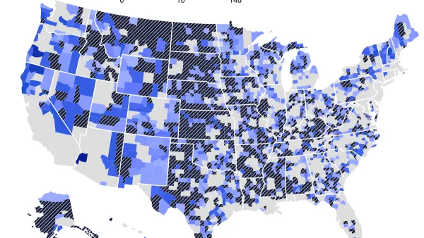
The EV “Charging Divide” Plaguing Rural America
With “the deck stacked” against rural areas, will the great electric American road trip ever be a reality?

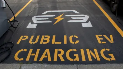
Walmart Announces Nationwide EV Charging Network
The company plans to install electric car chargers at most of its stores by 2030.
The Future of EV Charging Stations and Urban Planning
Explore the future of EV charging in cities and discover urban planning strategies for integrating electric vehicle infrastructure and promoting sustainable transportation.

Planetizen Federal Action Tracker
A weekly monitor of how Trump’s orders and actions are impacting planners and planning in America.

Maui's Vacation Rental Debate Turns Ugly
Verbal attacks, misinformation campaigns and fistfights plague a high-stakes debate to convert thousands of vacation rentals into long-term housing.

Restaurant Patios Were a Pandemic Win — Why Were They so Hard to Keep?
Social distancing requirements and changes in travel patterns prompted cities to pilot new uses for street and sidewalk space. Then it got complicated.

Charlottesville Temporarily Has No Zoning Code
A judge ordered the Virginia city to throw out its newly revised zoning code, leaving permitting for new development in legal limbo.

In California Battle of Housing vs. Environment, Housing Just Won
A new state law significantly limits the power of CEQA, an environmental review law that served as a powerful tool for blocking new development.

Boulder Eliminates Parking Minimums Citywide
Officials estimate the cost of building a single underground parking space at up to $100,000.
Urban Design for Planners 1: Software Tools
This six-course series explores essential urban design concepts using open source software and equips planners with the tools they need to participate fully in the urban design process.
Planning for Universal Design
Learn the tools for implementing Universal Design in planning regulations.
Heyer Gruel & Associates PA
JM Goldson LLC
Custer County Colorado
City of Camden Redevelopment Agency
City of Astoria
Transportation Research & Education Center (TREC) at Portland State University
Jefferson Parish Government
Camden Redevelopment Agency
City of Claremont