


The ForwardDallas plan is part of the city’s effort to make address exclusionary zoning practices, increase affordable housing for all residents, and bring essential businesses and services to more areas.
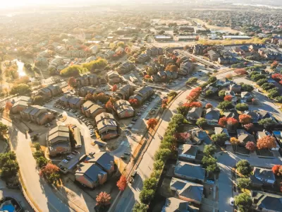
A land use plan years in the making in Dallas seeks to redress historic inequity in the city’s land use patterns, reports Leah Waters in The Dallas Morning News. The city will now hold public meetings to receive community input on the draft plan.
The plan, known as ForwardDallas, “will be the city’s first comprehensive land-use plan, which will be one factor in future zoning decisions, including how the city will accommodate more housing for a growing population,” said interim director of Dallas’ Planning and Urban Design department Andrea Gilles.
Rather than a strict rulebook, the plan will be a guide that “will help decision-makers understand how the land should be used without restricting certain kinds of development,” according to Gilles. It will also create more clarity around land use in areas that currently have no clear development guidelines.
“ForwardDallas’ color-coded map designates 12 particular “placetypes” or kinds of uses, such as Traditional Residential, which should be used for single-family homes and auxiliary dwellings, and Blended Residential, which is meant for single-family and multifamily homes,” but none of these types are limited to just one use. The plan is designed to allow for ‘context-sensitive’ land use decisions.
“The plan also allows the community to influence the “adjacency uses” of placetypes, which would allow neighborhoods to shape how near industrial development is to their homes,” Waters adds.
FULL STORY: City releases draft of first land-use plan to address inequity that’s divided Dallas

Updated: Proposed Parking Reforms Spark Controversy in Dallas
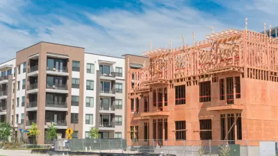
An ordinance under consideration by the Dallas City Council would change the parking requirements in the zoning code to allow for more density in exchange for affordable housing.

Zoning Reform and Tax Abatements Drive Cincinnati's New Housing Equity Agenda
New political leadership in Cincinnati is centering housing equity in a proposal that would ease zoning restrictions and streamline Low Income Housing Tax Credits, among other measures.

Dallas Housing Proposal Aims for Equity, Finally
Not only does the plan promise more affordable housing, it’s also supposed to deliver “access to more upwardly mobile communities."

Planetizen Federal Action Tracker
A weekly monitor of how Trump’s orders and actions are impacting planners and planning in America.

Restaurant Patios Were a Pandemic Win — Why Were They so Hard to Keep?
Social distancing requirements and changes in travel patterns prompted cities to pilot new uses for street and sidewalk space. Then it got complicated.

Map: Where Senate Republicans Want to Sell Your Public Lands
For public land advocates, the Senate Republicans’ proposal to sell millions of acres of public land in the West is “the biggest fight of their careers.”

Maui's Vacation Rental Debate Turns Ugly
Verbal attacks, misinformation campaigns and fistfights plague a high-stakes debate to convert thousands of vacation rentals into long-term housing.

San Francisco Suspends Traffic Calming Amidst Record Deaths
Citing “a challenging fiscal landscape,” the city will cease the program on the heels of 42 traffic deaths, including 24 pedestrians.

California Homeless Arrests, Citations Spike After Ruling
An investigation reveals that anti-homeless actions increased up to 500% after Grants Pass v. Johnson — even in cities claiming no policy change.
Urban Design for Planners 1: Software Tools
This six-course series explores essential urban design concepts using open source software and equips planners with the tools they need to participate fully in the urban design process.
Planning for Universal Design
Learn the tools for implementing Universal Design in planning regulations.
Heyer Gruel & Associates PA
JM Goldson LLC
Custer County Colorado
City of Camden Redevelopment Agency
City of Astoria
Transportation Research & Education Center (TREC) at Portland State University
Camden Redevelopment Agency
City of Claremont
Municipality of Princeton (NJ)