


A state plan to widen an interstate that cuts through downtown Las Vegas would displace hundreds of homes and businesses.

Las Vegas residents are questioning a proposal by the Nevada Department of Transportation to widen Interstate 515, also known as US-95, in downtown Las Vegas, writes April Corbin Girnus in Nevada Current.
NDOT says a massive increase in traffic volumes since the freeway was built in 1968, along with aging infrastructure and outdated design, are causing congestion and “creating potentially dangerous driving conditions.”
“But at least three dozen downtown households are expected to be displaced as part of the project, which would take several years and billions of dollars to complete. Upwards of 350 households potentially could be displaced, depending on which design the agency decides to pursue.” Local residents say the widening would primarily benefit suburban commuters at the expense of air quality in the city’s core.
NDOT has offered up eight possible alternatives for the project, including a ‘no-build’ option that would leave the roadway unchanged but call for safety improvements. The article notes that “None of the plans include walking and bike trails adjacent to the freeway, which is something NDOT proposed in its original designs but axed after hearing concerns about such areas attracting homeless people.”
However, “As part of its project mitigation plan, NDOT has proposed committing $20 million for ‘Complete Streets’ projects, $15 million to replace on a 1-to-1 ratio any household units it razes as part of right-of-way acquisition, $10 million for ‘resources for the unhoused community,’ and $10 million for an indoor recreation area to replace the existing ones it would tear down.”
FULL STORY: ‘Who does this help?’ US-95 widening project draws ire from downtown residents

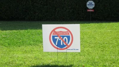
LA Metro Board Approves New 710 Freeway Plan
The newest plan for the 710 corridor claims it will not displace any residents.
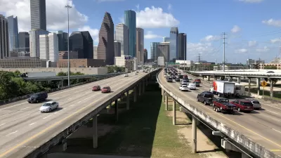
Houston Interstate Widening Continues To Threaten Communities
The proposed freeway expansion in downtown Houston has faced searing backlash from local residents who see the project as a relic of the era of rampant freeway construction and neighborhood disruption.
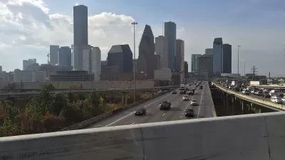
Contentious Houston Freeway Widening Project Inches Forward
Federal officials have given TxDOT the go-ahead to resume work on a small portion of a controversial interstate widening project in downtown Houston.

Maui's Vacation Rental Debate Turns Ugly
Verbal attacks, misinformation campaigns and fistfights plague a high-stakes debate to convert thousands of vacation rentals into long-term housing.

Planetizen Federal Action Tracker
A weekly monitor of how Trump’s orders and actions are impacting planners and planning in America.

In Urban Planning, AI Prompting Could be the New Design Thinking
Creativity has long been key to great urban design. What if we see AI as our new creative partner?

King County Supportive Housing Program Offers Hope for Unhoused Residents
The county is taking a ‘Housing First’ approach that prioritizes getting people into housing, then offering wraparound supportive services.

Researchers Use AI to Get Clearer Picture of US Housing
Analysts are using artificial intelligence to supercharge their research by allowing them to comb through data faster. Though these AI tools can be error prone, they save time and housing researchers are optimistic about the future.

Making Shared Micromobility More Inclusive
Cities and shared mobility system operators can do more to include people with disabilities in planning and operations, per a new report.
Urban Design for Planners 1: Software Tools
This six-course series explores essential urban design concepts using open source software and equips planners with the tools they need to participate fully in the urban design process.
Planning for Universal Design
Learn the tools for implementing Universal Design in planning regulations.
planning NEXT
Appalachian Highlands Housing Partners
Mpact (founded as Rail~Volution)
City of Camden Redevelopment Agency
City of Astoria
City of Portland
City of Laramie