


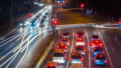
Congestion is increasing much faster than vehicle miles traveled, suggesting that the “new normal” of hybrid work and an influx of suburban residents is taking a toll on the nation's transportation system.

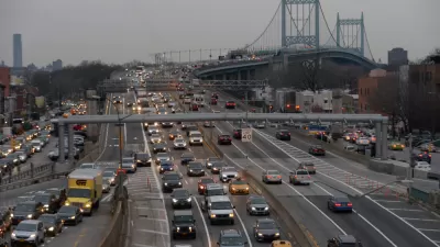
Vehicle miles traveled in the United States still haven’t recovered to pre-pandemic totals, according to the most recent data calculating American’s automobile travel habits in 2022.
“Vehicle miles traveled (VMT) in the U.S. totaled 3.17 trillion last year, according to preliminary estimates from FHWA,” according to an article by the State Smart Transportation Initiative. “That is a one percent increase from 2021 and a nine percent increase from 2020—the height of the pandemic—but still nearly three percent lower than VMT in 2019.” Adjusting for population, the per capita driving rate is four percent lower than 2019, according to the article.
While much of the news about transportation habits after the pandemic has focused on transit ridership, which is still much lower than pre-pandemic levels relative to vehicle miles traveled, the latest data on driving indicates that even drivers are staying home more. Because Inrix has reported that congestion increased between 2021 and 2022 (the usual caveats about the Inrix congestion-reporting methodology apply), the State Smart Transportation Initiative suggests that the data suggest new travel patterns have shifted traffic volumes to more of the day—with longer periods of time now susceptible to congestion and a “new normal” continuing to solidify.
FULL STORY: Americans are still driving less than before the pandemic


Planning for Congestion Relief
The third and final installment of Planetizen's examination of the role of the planning profession in both perpetuating and solving traffic congestion.
Where the Pandemic Has Scrambled Traffic Patterns
The map of metropolitan areas that drive least, and thus emit fewer greenhouse gas emissions, has been completely redrawn by the pandemic, according to a recent report.
Report: Vehicle Miles Traveled Almost Fully Returned to Pre-Pandemic Levels
Reports last week that the U.S. economy is about 30 percent smaller than before the pandemic aren't reflected in driving trends.

Maui's Vacation Rental Debate Turns Ugly
Verbal attacks, misinformation campaigns and fistfights plague a high-stakes debate to convert thousands of vacation rentals into long-term housing.

Planetizen Federal Action Tracker
A weekly monitor of how Trump’s orders and actions are impacting planners and planning in America.

Chicago’s Ghost Rails
Just beneath the surface of the modern city lie the remnants of its expansive early 20th-century streetcar system.

Bend, Oregon Zoning Reforms Prioritize Small-Scale Housing
The city altered its zoning code to allow multi-family housing and eliminated parking mandates citywide.

Amtrak Cutting Jobs, Funding to High-Speed Rail
The agency plans to cut 10 percent of its workforce and has confirmed it will not fund new high-speed rail projects.

LA Denies Basic Services to Unhoused Residents
The city has repeatedly failed to respond to requests for trash pickup at encampment sites, and eliminated a program that provided mobile showers and toilets.
Urban Design for Planners 1: Software Tools
This six-course series explores essential urban design concepts using open source software and equips planners with the tools they need to participate fully in the urban design process.
Planning for Universal Design
Learn the tools for implementing Universal Design in planning regulations.
planning NEXT
Appalachian Highlands Housing Partners
Mpact (founded as Rail~Volution)
City of Camden Redevelopment Agency
City of Astoria
City of Portland
City of Laramie