


A tool designed to guide federal grant distribution may not prioritize the highest-need communities, while conflicting grant guidelines create challenges for local agencies.
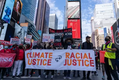
A screening tool employed by the federal government in classifying areas as “historically disadvantaged” is meeting with concern from environmental justice advocates who say the assessment doesn’t accurately identify “the places where residents have been hardest hit by pollution and other environmental harms.” Daniel C. Vock outlines the tool’s history and the controversy surrounding it in Route Fifty.
The tool, part of President Biden’s Justice40 initiative, is designed to direct federal grant funds to the communities that need it most. For example, “Advocates complained that the initial release failed to include Appalachian areas with abandoned coal mines, vast stretches of Alaska or places with multiple environmental and health threats.” But when the tool was updated to address those concerns, “the places that the White House added with updates were predominantly white and rural, and they do not face the types of cumulative danger found elsewhere,” according to Dana Johnson, the senior director of strategy and federal policy for WE ACT for Environmental Justice.
Vock explains that the administration opted against using race as a factor to avoid having to engage in the same protracted legal battles encountered by other federal programs. “A WE ACT analysis found that the percentage of white residents in neighborhoods identified by the White House screening tool increased by 4.5% after the revisions. The number of Hispanic residents decreased by 2.8% and Black residents decreased by 1.8%.”
The White House tool also differs from standards used by other federal agencies, which have developed their own methods for selecting grantees. “On top of that, 30 states and localities have developed similar screening tools, according to the Environmental Policy Innovation Center,” creating a headache for local agencies seeking grant funding.
FULL STORY: White House’s Environmental Justice Tool Still Comes Up Short, Advocates Say


EPA Grants Target Environmental Justice
The agency will administer $100 million in grants to cities, states, and tribal nations as part of the Biden administration’s Justice40 initiative.

Future of Justice40 Initiative Hinges on Election
The program requires that 40 percent of some federal funds be used to benefit historically disadvantaged communities.
Mapping Environmental Justice to Census Tracts
The Climate and Economic Justice Screening Tool, version 1.0, is now available on the internet.

Planetizen Federal Action Tracker
A weekly monitor of how Trump’s orders and actions are impacting planners and planning in America.

Maui's Vacation Rental Debate Turns Ugly
Verbal attacks, misinformation campaigns and fistfights plague a high-stakes debate to convert thousands of vacation rentals into long-term housing.

San Francisco Suspends Traffic Calming Amidst Record Deaths
Citing “a challenging fiscal landscape,” the city will cease the program on the heels of 42 traffic deaths, including 24 pedestrians.

Defunct Pittsburgh Power Plant to Become Residential Tower
A decommissioned steam heat plant will be redeveloped into almost 100 affordable housing units.

Trump Prompts Restructuring of Transportation Research Board in “Unprecedented Overreach”
The TRB has eliminated more than half of its committees including those focused on climate, equity, and cities.

Amtrak Rolls Out New Orleans to Alabama “Mardi Gras” Train
The new service will operate morning and evening departures between Mobile and New Orleans.
Urban Design for Planners 1: Software Tools
This six-course series explores essential urban design concepts using open source software and equips planners with the tools they need to participate fully in the urban design process.
Planning for Universal Design
Learn the tools for implementing Universal Design in planning regulations.
Heyer Gruel & Associates PA
JM Goldson LLC
Custer County Colorado
City of Camden Redevelopment Agency
City of Astoria
Transportation Research & Education Center (TREC) at Portland State University
Jefferson Parish Government
Camden Redevelopment Agency
City of Claremont