


A new tool developed in British Columbia calculates the cost of infrastructure over the entire life cycle of the project.
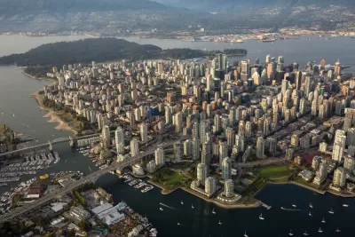
Writing in the Strong Towns Journal, Seairra Sheppard describes a free tool developed by the Province of British Columbia “designed to help local municipalities ‘estimate the lifecycle cost implications of different land use patterns over a 100-year period,’” making it easier to make informed land use and infrastructure decisions.
The community lifecycle infrastructure costing tool (CLIC tool) “can help local governments estimate the entire lifecycle costs of infrastructure, such as water, sewer and transportation, for different land use patterns, for example, compact- versus low-density development.”
According to Sheppard, the tool “has the ability to generate long-term infrastructure cost implications through a comparison analysis.” Several municipalities have already tested it out, including Prince George, which used CLIC to calculate the costs of building a new low-density subdivision compared to a medium-density infill development. The city found that “[i]nitial capital costs in the infill scenario are a mere fraction (about 94–97% lower) than that of the subdivision scenario.” Provincial leaders hope that making CLIC available freely will help cities gather more information about long-range impacts before making major infrastructure investments.
FULL STORY: A New Tool to Calculate the Lifecycle of Infrastructure

Why Infrastructure Costs So Much
A new book details what planners already know: cost estimates for major infrastructure projects are usually a farce. Another book foretells just how much new infrastructure will be needed in the coming waves of climate migration.

More Delays, Billions for the Northeast Corridor’s Gateway Program
Considered by some to be the most critical infrastructure project in the country, the Gateway Project is an ongoing example of the extreme costs of bureaucratic and political neglect.
Toronto Reconsidering its Parking Requirements
Parking reform is reaching new frontiers.

Planetizen Federal Action Tracker
A weekly monitor of how Trump’s orders and actions are impacting planners and planning in America.

Restaurant Patios Were a Pandemic Win — Why Were They so Hard to Keep?
Social distancing requirements and changes in travel patterns prompted cities to pilot new uses for street and sidewalk space. Then it got complicated.

Map: Where Senate Republicans Want to Sell Your Public Lands
For public land advocates, the Senate Republicans’ proposal to sell millions of acres of public land in the West is “the biggest fight of their careers.”

Maui's Vacation Rental Debate Turns Ugly
Verbal attacks, misinformation campaigns and fistfights plague a high-stakes debate to convert thousands of vacation rentals into long-term housing.

San Francisco Suspends Traffic Calming Amidst Record Deaths
Citing “a challenging fiscal landscape,” the city will cease the program on the heels of 42 traffic deaths, including 24 pedestrians.

California Homeless Arrests, Citations Spike After Ruling
An investigation reveals that anti-homeless actions increased up to 500% after Grants Pass v. Johnson — even in cities claiming no policy change.
Urban Design for Planners 1: Software Tools
This six-course series explores essential urban design concepts using open source software and equips planners with the tools they need to participate fully in the urban design process.
Planning for Universal Design
Learn the tools for implementing Universal Design in planning regulations.
Heyer Gruel & Associates PA
JM Goldson LLC
Custer County Colorado
City of Camden Redevelopment Agency
City of Astoria
Transportation Research & Education Center (TREC) at Portland State University
Camden Redevelopment Agency
City of Claremont
Municipality of Princeton (NJ)