


The lane marking was meant to raise awareness and instill shared respect among drivers and cyclists. But their inefficiency has led supporters to denounce sharrows, pushing instead for more robust bike infrastructure that truly protects riders.

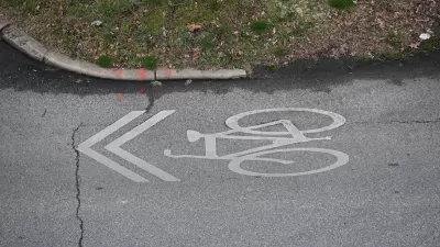
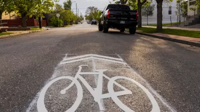
Dave Snyder, senior director for infrastructure at PeopleForBikes and the former executive director of the California Bicycle Coalition, was an early and enthusiastic supporter of the sharrow, a lane marking designed to make drivers aware that they are sharing space with bikes and encourage people on bikes to claim the lane rather than riding in the dangerous ‘door zone.’
According to Snyder, “I thought the sharrow would educate bicyclists to stay out of the ‘door zone’ and usher in a new era of safer streets, one where motorists would patiently wait behind bicyclists ‘taking the lane’ because this painted symbol made it clear they had the right to do so.” But Snyder admits the markings are clearly not enough to change behavior. “Sharrow or no sharrow, most people on bikes dangerously hug the edge of the roadway, squeezing themselves into the door zone to avoid blocking car traffic.” Now, after two decades of data and lived experience, Snyder believes that sharrows “are great for navigation and, perhaps, concentrating riders on certain streets — that’s about it.”
If anything, Snyder points out that sharrows have an unintended effect that is “insulting” to the bike-riding public: “They allow officials to take credit for doing something for bicycle safety without impacting car traffic, even though that something is next to nothing.”
Snyder emphasizes that bike advocates like him and his current organization, PeopleForBikes, now acknowledge the failures of sharrows and have stopped recommending them. “Today, we know so much more about what it takes to make our streets safer for bicycling. We need separate bike paths; we need protected bike lanes on busy roads; and where the lanes are shared, we need actual speeds reduced to 20 mph or slower.”
FULL STORY: Big Admission: ‘I Was Wrong About Sharrows’

Sharrows Are Ineffective, Potentially Counterproductive
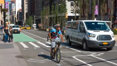
Research shows there’s no substitute for protected bike lanes, and sharrows may make roads more dangerous for cyclists.
Calls to Stop Relying on Sharrows Grow Louder
The painted symbols can not only fail to protect bike riders, but can actually make riding conditions less safe.
Is ‘Protected Bike Lane’ an Oxymoron?
Some research suggests that separated and even ‘protected’ bike lanes actually increase the likelihood of car-bike collisions.

Maui's Vacation Rental Debate Turns Ugly
Verbal attacks, misinformation campaigns and fistfights plague a high-stakes debate to convert thousands of vacation rentals into long-term housing.

Planetizen Federal Action Tracker
A weekly monitor of how Trump’s orders and actions are impacting planners and planning in America.

In Urban Planning, AI Prompting Could be the New Design Thinking
Creativity has long been key to great urban design. What if we see AI as our new creative partner?

King County Supportive Housing Program Offers Hope for Unhoused Residents
The county is taking a ‘Housing First’ approach that prioritizes getting people into housing, then offering wraparound supportive services.

Researchers Use AI to Get Clearer Picture of US Housing
Analysts are using artificial intelligence to supercharge their research by allowing them to comb through data faster. Though these AI tools can be error prone, they save time and housing researchers are optimistic about the future.

Making Shared Micromobility More Inclusive
Cities and shared mobility system operators can do more to include people with disabilities in planning and operations, per a new report.
Urban Design for Planners 1: Software Tools
This six-course series explores essential urban design concepts using open source software and equips planners with the tools they need to participate fully in the urban design process.
Planning for Universal Design
Learn the tools for implementing Universal Design in planning regulations.
planning NEXT
Appalachian Highlands Housing Partners
Mpact (founded as Rail~Volution)
City of Camden Redevelopment Agency
City of Astoria
City of Portland
City of Laramie