


The Waymap app offers precise instructions to give blind pedestrians more options for safe travel.
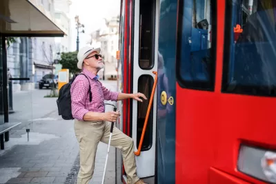
“An app designed to help visually impaired or blind pedestrians use public transit will debut at a Washington subway station on Tuesday,” reports David Shepardson for Reuters. “The app does not use GPS and can operate regardless of cellphone signal strength indoors or outdoors. It loads detailed mapping data onto a smartphone and uses motion sensors on the phone to offer precise directions.”
“Mobility is not a luxury,” said Waymap founder and CEO Tom Pey, who is blind and argues other apps are not precise enough. “It is, in fact, a human right.”
According to the article, “Waymap will be deployed in phases with the goal of deploying the app at up to 30 Metro train stations and nearly 1,000 bus stops by September and across the entire Metro system by early 2023.”
In the future, Pey says people without visual impairments could use the app “to help refine directions and improve the maps” for blind users.
FULL STORY: App to help blind people navigate public transit to debut in Washington

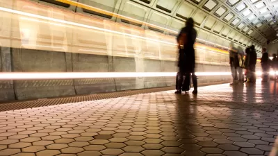
Mobile App Makes DC Transit Easy to Navigate for Visually Impaired Riders
The app gives step-by-step directions and audio and visual cues accessible from anywhere for thousands of bus stops and rail stations.

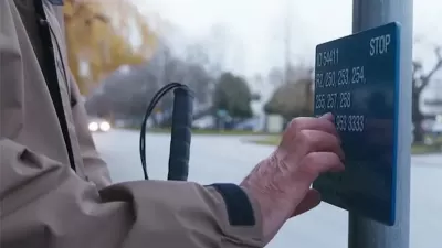
Making Trip Planning Easier for Vision-Impaired Transit Riders
The app provides navigation using audio and haptic cues to improve accessibility for people with low vision.
Braille Signage Now at All Vancouver Bus Stops
The city completed installation of signage for people with visual impairments at over 8,000 bus stops.

Maui's Vacation Rental Debate Turns Ugly
Verbal attacks, misinformation campaigns and fistfights plague a high-stakes debate to convert thousands of vacation rentals into long-term housing.

Planetizen Federal Action Tracker
A weekly monitor of how Trump’s orders and actions are impacting planners and planning in America.

In Urban Planning, AI Prompting Could be the New Design Thinking
Creativity has long been key to great urban design. What if we see AI as our new creative partner?

Massachusetts Budget Helps Close MBTA Budget Gap
The budget signed by Gov. Maura Healey includes $470 million in MBTA funding for the next fiscal year.

Milwaukee Launches Vision Zero Plan
Seven years after the city signed its Complete Streets Policy, the city is doubling down on its efforts to eliminate traffic deaths.

Portland Raises Parking Fees to Pay for Street Maintenance
The city is struggling to bridge a massive budget gap at the Bureau of Transportation, which largely depleted its reserves during the Civd-19 pandemic.
Urban Design for Planners 1: Software Tools
This six-course series explores essential urban design concepts using open source software and equips planners with the tools they need to participate fully in the urban design process.
Planning for Universal Design
Learn the tools for implementing Universal Design in planning regulations.
Gallatin County Department of Planning & Community Development
Heyer Gruel & Associates PA
JM Goldson LLC
City of Camden Redevelopment Agency
City of Astoria
Transportation Research & Education Center (TREC) at Portland State University
Jefferson Parish Government
Camden Redevelopment Agency
City of Claremont