


The city is creating a strategy for improvements in the Clark Street corridor to improve the area's walkability and stimulate the local economy.

Chicago's Department of Planning and Development is soliciting stakeholder input to develop a plan for Clark Street, a major commercial thoroughfare that connects some of the city's most historic neighborhoods, including Uptown and Wrigleyville.
As part of its study of the area, the city wants to "identify opportunities for new development, zoning enhancements and public realm improvements" that will drive more pedestrians to Clark Street and its businesses. According to the project's website, the study will examine ways to improve streetscapes "to promote additional comfort and safety for pedestrians and cyclists" and introduce "uses that increase foot traffic to the area."
The article notes that the study is funded by $250,000 from the Clark/Montrose Tax Increment Financing (TIF) District, a financing mechanism that uses property tax growth to promote public and private investment in a designated district. The DPD plans to release the final study and its recommendations in June 2022.
FULL STORY: City Launches Public Engagement Activities for ‘Clark Street Crossroads’

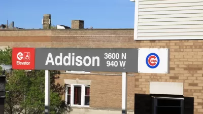
Risk and Reward in Play With Wrigleyville Developments
A wave of investments is visiting one of the most famous, and notorious, neighborhoods in the city of Chicago. The question is whether the final product will be worth the expense.
Op-Ed: Chicago's Washington Park a Perfect Fit for TIF
An op-ed in the Chicago Tribune addresses the long history of tax increment financing abuse in Chicago, but supports a proposed TIF district for Washington Park.

Chicago Judge Orders Thousands of Accessible Ped Signals
Only 3% of the city's crossing signals are currently accessible to blind pedestrians.

Maui's Vacation Rental Debate Turns Ugly
Verbal attacks, misinformation campaigns and fistfights plague a high-stakes debate to convert thousands of vacation rentals into long-term housing.

Planetizen Federal Action Tracker
A weekly monitor of how Trump’s orders and actions are impacting planners and planning in America.

In Urban Planning, AI Prompting Could be the New Design Thinking
Creativity has long been key to great urban design. What if we see AI as our new creative partner?

King County Supportive Housing Program Offers Hope for Unhoused Residents
The county is taking a ‘Housing First’ approach that prioritizes getting people into housing, then offering wraparound supportive services.

Researchers Use AI to Get Clearer Picture of US Housing
Analysts are using artificial intelligence to supercharge their research by allowing them to comb through data faster. Though these AI tools can be error prone, they save time and housing researchers are optimistic about the future.

Making Shared Micromobility More Inclusive
Cities and shared mobility system operators can do more to include people with disabilities in planning and operations, per a new report.
Urban Design for Planners 1: Software Tools
This six-course series explores essential urban design concepts using open source software and equips planners with the tools they need to participate fully in the urban design process.
Planning for Universal Design
Learn the tools for implementing Universal Design in planning regulations.
planning NEXT
Appalachian Highlands Housing Partners
Mpact (founded as Rail~Volution)
City of Camden Redevelopment Agency
City of Astoria
City of Portland
City of Laramie