


The city is using restriping, delineators, and other traffic calming measures to fight reckless driving and improve pedestrian safety.

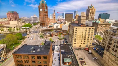
As Jeramey Jannene reports, Milwaukee's Department of Public Works tested three traffic calming improvements in 2021 as "part of a growing effort by the City of Milwaukee to use infrastructure to prevent or deter reckless driving," which some experts have called a public health epidemic.
The projects, which cost the city $300,000, included curb extensions, delineators, and high-visibility crosswalks on three corridors and are intended to test the effectiveness of the various strategies. The traffic calming initiatives reduce the distance pedestrians need to cross and prevent drivers from passing in non-driving lanes.
"The three paint-and-post projects build on five 2020 projects that included lane restriping, paint-and-post treatments and other reconfigurations. One 2020 project, N. 27th St., was already upgraded to include one-ton planters atop the painted curb extensions," according to the article. The city plans to use $3.8 million in funding from the American Rescue Plan to implement 16 similar projects next year, following Acting Mayor Cavalier Johnson's pledge to address reckless driving as a public health crisis.
FULL STORY: Three Projects Test Traffic Calming

Milwaukee Traffic Safety Projects To Receive $8.5 Million in TIF Funds
The city hopes to combat a growing reckless driving 'crisis' with traffic calming, bike lanes, and other projects aimed at improving roadway safety.
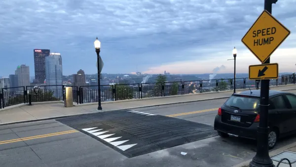
Pittsburgh Excels at Low-Cost, Quick-Build Traffic Calming
The city’s traffic calming initiative has led to a 6 percent average reduction in speeds on corridors with recent interventions.
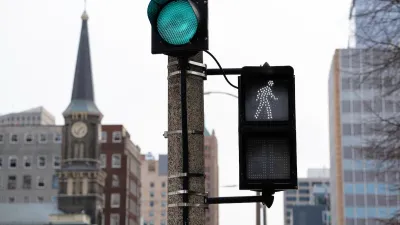
Milwaukee Announces 60 Traffic Calming Projects for 2025
The city has successfully reduced traffic deaths and aims to eliminate them completely within the next decade.

Maui's Vacation Rental Debate Turns Ugly
Verbal attacks, misinformation campaigns and fistfights plague a high-stakes debate to convert thousands of vacation rentals into long-term housing.

Planetizen Federal Action Tracker
A weekly monitor of how Trump’s orders and actions are impacting planners and planning in America.

In Urban Planning, AI Prompting Could be the New Design Thinking
Creativity has long been key to great urban design. What if we see AI as our new creative partner?

King County Supportive Housing Program Offers Hope for Unhoused Residents
The county is taking a ‘Housing First’ approach that prioritizes getting people into housing, then offering wraparound supportive services.

Researchers Use AI to Get Clearer Picture of US Housing
Analysts are using artificial intelligence to supercharge their research by allowing them to comb through data faster. Though these AI tools can be error prone, they save time and housing researchers are optimistic about the future.

Making Shared Micromobility More Inclusive
Cities and shared mobility system operators can do more to include people with disabilities in planning and operations, per a new report.
Urban Design for Planners 1: Software Tools
This six-course series explores essential urban design concepts using open source software and equips planners with the tools they need to participate fully in the urban design process.
Planning for Universal Design
Learn the tools for implementing Universal Design in planning regulations.
planning NEXT
Appalachian Highlands Housing Partners
Mpact (founded as Rail~Volution)
City of Camden Redevelopment Agency
City of Astoria
City of Portland
City of Laramie