


Transforming suburban sprawl is a massive undertaking, but these small steps can help communities understand their needs and assets and develop clear, actionable goals for the future.
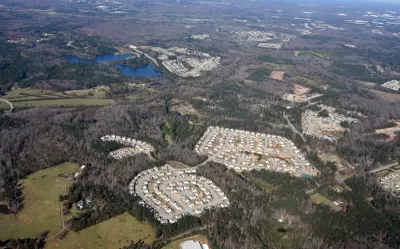
Pedestrianizing the suburbs might seem like a monumental challenge, writes Robert Steutenville, but a new report from the Congress for New Urbanism (CNU) and the Michigan Municipal League outlines a list of small, incremental steps that communities can implement to move toward less auto-oriented, more walkable and mixed-use neighborhoods. "Reorienting suburban neighborhoods for pedestrians requires an incremental yet integrated approach, calibrated to local needs, prioritized according to public aspirations, and targeted to specific areas within the community."
The list includes "proven techniques" drawn from successful projects from across the United States, ranging from identifying existing assets and future goals to aligning codes and ordinances to reforming parking regulations. These interventions act at a hyper-local level to identify community needs, leverage existing resources, and change regulations to support and anticipate higher density and pedestrian-friendly infrastructure. Adjusting land use regulations and parking requirements can go a long way toward "offering an alternative vision for existing buildings" and "adapting from placeless sprawl to walkable urbanism" by easing the way for adaptive reuse and denser development. "The process of rescaling suburban communities can be long and difficult, but seeing the road ahead will help a municipality measure their success, manage development outcomes, and maintain a sense of place amidst change."
FULL STORY: Incremental steps toward pedestrian-friendly suburbs

Higher Quality Won't Prevent NIMBYism
Some argue that neighborhoods will be willing to accept new housing as long as it is high quality; this argument overlooks a wide variety of other objections to new housing.

How Park Design Helps Keep Communities Healthy
A review of the healthiest cities in the United States establishes that urban parks play a vital role in the activity of a city. What conclusions can be drawn from each city?
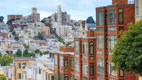
Opinion: What San Francisco’s Proposed ‘Family Zoning’ Could Really Mean
Mayor Lurie is using ‘family zoning’ to encourage denser development and upzoning — but could the concept actually foster community and more human-scale public spaces?

Maui's Vacation Rental Debate Turns Ugly
Verbal attacks, misinformation campaigns and fistfights plague a high-stakes debate to convert thousands of vacation rentals into long-term housing.

Planetizen Federal Action Tracker
A weekly monitor of how Trump’s orders and actions are impacting planners and planning in America.

San Francisco Suspends Traffic Calming Amidst Record Deaths
Citing “a challenging fiscal landscape,” the city will cease the program on the heels of 42 traffic deaths, including 24 pedestrians.

Bend, Oregon Zoning Reforms Prioritize Small-Scale Housing
The city altered its zoning code to allow multi-family housing and eliminated parking mandates citywide.

Amtrak Cutting Jobs, Funding to High-Speed Rail
The agency plans to cut 10 percent of its workforce and has confirmed it will not fund new high-speed rail projects.

LA Denies Basic Services to Unhoused Residents
The city has repeatedly failed to respond to requests for trash pickup at encampment sites, and eliminated a program that provided mobile showers and toilets.
Urban Design for Planners 1: Software Tools
This six-course series explores essential urban design concepts using open source software and equips planners with the tools they need to participate fully in the urban design process.
Planning for Universal Design
Learn the tools for implementing Universal Design in planning regulations.
planning NEXT
Appalachian Highlands Housing Partners
Mpact (founded as Rail~Volution)
City of Camden Redevelopment Agency
City of Astoria
City of Portland
City of Laramie