New Analysis Tools Measures Transportation Health Impacts

The Integrated Transport and Health Impact Model estimates how planning decisions affect public health, including physical activity, collisions and vehicle exhaust. This can help create healthier communities.
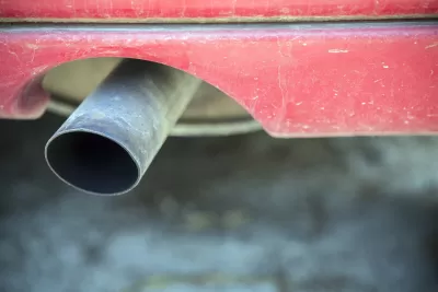
2 minute read

November 27, 2020, 6:00 AM PST

By Todd Litman


Tailpipe

Fabianodp / Shutterstock

The Healthy Mobility Options Tool is a new health impact analysis model that quantitatively answers the question of “How much benefit or harm to human health can we expect by changing the mix of active and motorized travel across a county, region, or the entire state?” The tool calculates the change in deaths, years of life shortening and disability, and costs due to changes in air pollution, physical activity, and traffic injuries associated with changes in active transportation levels (i.e., walking and cycling) on a population level.

This tool is a new, web-based version of the California Integrated Transport and Health Impact Model (ITHIM). In California, ITHIM has been used to assess the health impacts of regional transportation plans, goals of state and local agencies, and city and regional transportation projects. The Healthy Mobility Options Tool is the result of a collaboration between the California Air Resources Board (CARB) and California Department of Public Health (CDPH), with web development provided by UC Davis, that transforms the previous, spreadsheet-based version of California ITHIM into a new, user-friendly web-based platform.
This has important implications. Current planning tends to overlook or undervalue many of the health risks caused by policies and planning decisions that increase automobile travel, and the many health benefits provided by more multi-modal transportation planning, and from creating more compact, walkable neighborhoods. This tool not only quantifies these impacts, it also monetizes them, allowing decision-makers to compare them with other benefits and costs, such as travel time savings.

A free webinar introducing the this tool will take place on Monday, December 7, 2020 from 9:00 - 9:30 a.m. Pacific Time Zone. This webinar is oriented towards organizational leaders, planners, and policy-oriented staff whose work is related to health and transportation. Participants will learn what the tool is and examples of use cases. There will be a short live demo of the tool, including the equity modules that give income-level and race-specific results. Participants will be able to better identify the appropriate users in their organization and provide them with information on the tool. 

Wednesday, November 25, 2020 in Integrated Transport and Health Impact Model

portrait of professional woman

I love the variety of courses, many practical, and all richly illustrated. They have inspired many ideas that I've applied in practice, and in my own teaching. Mary G., Urban Planner

I love the variety of courses, many practical, and all richly illustrated. They have inspired many ideas that I've applied in practice, and in my own teaching.

Mary G., Urban Planner

Cover CM Credits, Earn Certificates, Push Your Career Forward

Logo for Planetizen Federal Action Tracker with black and white image of U.S. Capitol with water ripple overlay.

Planetizen Federal Action Tracker

A weekly monitor of how Trump’s orders and actions are impacting planners and planning in America.

June 25, 2025 - Diana Ionescu

Map of Western U.S. indicating public lands that would be for sale under a Senate plan in yellow and green.

Map: Where Senate Republicans Want to Sell Your Public Lands

For public land advocates, the Senate Republicans’ proposal to sell millions of acres of public land in the West is “the biggest fight of their careers.”

June 19, 2025 - Outdoor Life

Person wearing mask walking through temporary outdoor dining setup lined with bistro lights at dusk in New York City.

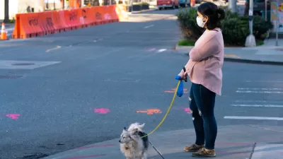
Restaurant Patios Were a Pandemic Win — Why Were They so Hard to Keep?

Social distancing requirements and changes in travel patterns prompted cities to pilot new uses for street and sidewalk space. Then it got complicated.

June 19, 2025 - Diana Ionescu

Close-up of full beer glass with purple train-themed design sitting on bar between two frosty tall cans.

Platform Pilsner: Vancouver Transit Agency Releases... a Beer?

TransLink will receive a portion of every sale of the four-pack.

4 hours ago - Cities Today

Vintage red Toronto streetcar passing in front of Rogers Arena in Toronto, Canada.

Toronto Weighs Cheaper Transit, Parking Hikes for Major Events

Special event rates would take effect during large festivals, sports games and concerts to ‘discourage driving, manage congestion and free up space for transit.”

5 hours ago - blogTO

Map of Berlin with ring roads in green and red.

Berlin to Consider Car-Free Zone Larger Than Manhattan

The area bound by the 22-mile Ringbahn would still allow 12 uses of a private automobile per year per person, and several other exemptions.

6 hours ago - Streetsblog USA

Urban Design for Planners 1: Software Tools

This six-course series explores essential urban design concepts using open source software and equips planners with the tools they need to participate fully in the urban design process.

Planning for Universal Design

Learn the tools for implementing Universal Design in planning regulations.