


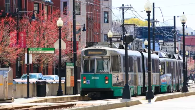
Raising density around transit stations to a level already existing in some parts of the city would enable hundreds of thousands of new housing units in and around Boston, according to a thought experiment by the Massachusetts Housing Partnership.
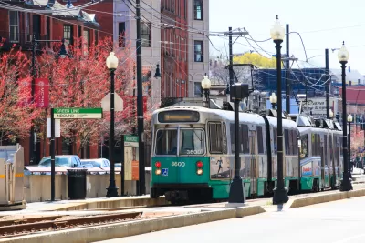
"Housing-starved Massachusetts could add a quarter-million homes just by building more around MBTA stations," reports Tim Logan, reporting the analysis of a new study published this week by the Massachusetts Housing Partnership.
The nonprofit housing advocacy organization "studied and mapped development patterns around 284 stations on the Massachusetts Bay Transportation Authority’s rapid transit and commuter rail lines and found that more than 517,000 houses and apartments are within a half-mile of a station," explains Logan. The organization also created an online mapping tool to explore transit oriented development opportunities around MBTA stations.
A little more density, however, could make room for a lot more housing. "About 253,000 more could be added if land around all of the transit system’s stations averaged 10 housing units per acre, instead of the current 6.4."
Researchers at the organization describe the report as a thought experiment, but that speculative density of ten units per acre is already a reality around multiple transit stations on the MBTA system, as listed in the article.
FULL STORY: Report says land at T stations could handle 253,000 housing units — and ease traffic gridlock

New Transit Oriented Zoning Criteria Proposed for Massachusetts
More details on the state of Massachusetts' game changing "Housing Choice" program are now available.
'Bespoke' Station Design Responsible for Transit Costs Increases, Study Says
The first case study by the Transit Costs Project at New York University's Marron Institute offers a long awaited, and long necessary, glimpse into the bloated costs of construction in the United States.
New York, Boston Transit Agencies Back Off Proposed Cuts
News of a potential economic stimulus package in Congress is followed by news that two of the nation's most prominent transit systems are reducing cuts proposed to address plummeting revenues.

Planetizen Federal Action Tracker
A weekly monitor of how Trump’s orders and actions are impacting planners and planning in America.

San Francisco's School District Spent $105M To Build Affordable Housing for Teachers — And That's Just the Beginning
SFUSD joins a growing list of school districts using their land holdings to address housing affordability challenges faced by their own employees.

The Tiny, Adorable $7,000 Car Turning Japan Onto EVs
The single seat Mibot charges from a regular plug as quickly as an iPad, and is about half the price of an average EV.

Seattle's Plan for Adopting Driverless Cars
Equity, safety, accessibility and affordability are front of mind as the city prepares for robotaxis and other autonomous vehicles.

As Trump Phases Out FEMA, Is It Time to Flee the Floodplains?
With less federal funding available for disaster relief efforts, the need to relocate at-risk communities is more urgent than ever.

With Protected Lanes, 460% More People Commute by Bike
For those needing more ammo, more data proving what we already knew is here.
Urban Design for Planners 1: Software Tools
This six-course series explores essential urban design concepts using open source software and equips planners with the tools they need to participate fully in the urban design process.
Planning for Universal Design
Learn the tools for implementing Universal Design in planning regulations.
Smith Gee Studio
City of Charlotte
City of Camden Redevelopment Agency
City of Astoria
Transportation Research & Education Center (TREC) at Portland State University
US High Speed Rail Association
City of Camden Redevelopment Agency
Municipality of Princeton (NJ)