


A writer in Toronto imagines how the city would be evaluated according to a "Run Score"—a fast-paced version of the Walk Score.

Alexander Bimm writes from Toronto, which has already seen a fair amount of research and investment into the city's walkability, resulting in a position as the second most walkable city in Canada. Given the health benefits, and even potentially the mobility benefits, of running, Bimm wonders about what it would take to produce a new runnability index, something called a "Run Score."
According to Bimm, Toronto has a network of trails that offer runners an embarrassment of riches that could help with a Run Score: "what makes Toronto so great for running is that you can run from your door and promptly arrive to a great network of trails within 10 minutes. In some other cities, by contrast, he has to bike or drive to a nearby trail before starting his run."
As for how the Run Score would be calculated, it would probably resemble the Walk Score. "But scoring runnability might also consider new factors that are based on how convenient it is for people to run in that area," according to Bimm. "In particular, a run score could highlight areas in the city that have access to running facilities and well-maintained trails. It can also consider the topography and speed limits of a neighbourhood."
Bimm also makes the case that the hypothetical run score could benefit planners by notifying them of parts of the city that need additional investments in public health. Residents would benefit by more awareness to the kinds of infrastructure that supports a healthy lifestyle.
FULL STORY: Run Score: Mapping Toronto’s Runnability

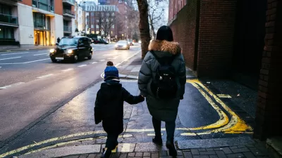
London Low-Emissions Zone Prompts Shift to Active Modes
More children are using active transportation modes to get to school in the wake of a policy that charges drivers to enter a low-emissions zone in central London.
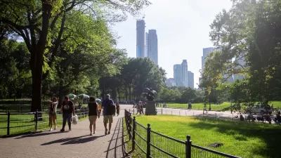
Green Spaces Benefit Neighborhoods—When Residents can Reach Them
A study comparing green space and walkability scores found that, without effective access to local parks, residents of greener neighborhoods don’t reap the health benefits.
How Long Covid Changes the Transportation Conversation
People living with long Covid symptoms can find themselves unable to make the same mobility choices they used to.

Maui's Vacation Rental Debate Turns Ugly
Verbal attacks, misinformation campaigns and fistfights plague a high-stakes debate to convert thousands of vacation rentals into long-term housing.

Planetizen Federal Action Tracker
A weekly monitor of how Trump’s orders and actions are impacting planners and planning in America.

In Urban Planning, AI Prompting Could be the New Design Thinking
Creativity has long been key to great urban design. What if we see AI as our new creative partner?

King County Supportive Housing Program Offers Hope for Unhoused Residents
The county is taking a ‘Housing First’ approach that prioritizes getting people into housing, then offering wraparound supportive services.

Researchers Use AI to Get Clearer Picture of US Housing
Analysts are using artificial intelligence to supercharge their research by allowing them to comb through data faster. Though these AI tools can be error prone, they save time and housing researchers are optimistic about the future.

Making Shared Micromobility More Inclusive
Cities and shared mobility system operators can do more to include people with disabilities in planning and operations, per a new report.
Urban Design for Planners 1: Software Tools
This six-course series explores essential urban design concepts using open source software and equips planners with the tools they need to participate fully in the urban design process.
Planning for Universal Design
Learn the tools for implementing Universal Design in planning regulations.
planning NEXT
Appalachian Highlands Housing Partners
Mpact (founded as Rail~Volution)
City of Camden Redevelopment Agency
City of Astoria
City of Portland
City of Laramie