


Toronto’s iconic Yonge Street is heavily used by pedestrians, and, according to this article, it's time for a revamp that acknowledges all of the street's users.
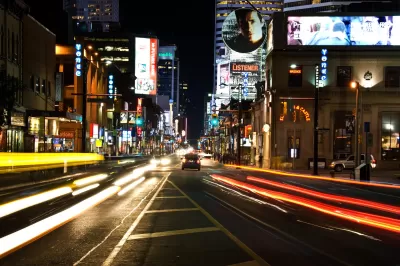
Matt Elliott makes the case for redesigning Yonge Street in Toronto to better accommodate pedestrians. "For a street so full of people — no street in Canada sees more daily pedestrian traffic than downtown Yonge Street — it feels hostile to pedestrians. It’s all narrow sidewalks and backed-up intersections."
As the population of the area is expected to grow in coming years, the street needs a design strategy that will account for increased foot traffic, says Elliott. "At all intersections in the core area, pedestrians make up between 50 per cent and 75 per cent of all traffic, but get less than 25 per cent of the road space."
The city of Toronto is hosting a series of public events, part of a study called yongeTOmorrow, to gather feedback about design options for Yonge Street. Two of the design options would narrow the roadway and increase pedestrian space. The third option, however, would ban most vehicles. "For much of the day, it would turn the entire street over to pedestrians. No cars and no trucks. Just people," notes Elliott.
FULL STORY: Give downtown Yonge St. to pedestrians

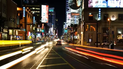
Pedestrian-Friendly Makeover of a Busy Toronto Street Stops Short of the Car-Free Ideal
The yongeTOmorrrow project is heading toward the finish line with widespread support from advocates, but a few want the plan to go one step further.

Denver to Shift Sidewalk Repair Work to City, Funded by Property Owners
The city is shifting from a piecemeal approach to sidewalk repairs that charged property owners with doing the work to a more streamlined, city-led process.
Where Urban Design Is Headed in 2024
A forecast of likely trends in urban design and architecture.

Maui's Vacation Rental Debate Turns Ugly
Verbal attacks, misinformation campaigns and fistfights plague a high-stakes debate to convert thousands of vacation rentals into long-term housing.

Planetizen Federal Action Tracker
A weekly monitor of how Trump’s orders and actions are impacting planners and planning in America.

Chicago’s Ghost Rails
Just beneath the surface of the modern city lie the remnants of its expansive early 20th-century streetcar system.

Bend, Oregon Zoning Reforms Prioritize Small-Scale Housing
The city altered its zoning code to allow multi-family housing and eliminated parking mandates citywide.

Amtrak Cutting Jobs, Funding to High-Speed Rail
The agency plans to cut 10 percent of its workforce and has confirmed it will not fund new high-speed rail projects.

LA Denies Basic Services to Unhoused Residents
The city has repeatedly failed to respond to requests for trash pickup at encampment sites, and eliminated a program that provided mobile showers and toilets.
Urban Design for Planners 1: Software Tools
This six-course series explores essential urban design concepts using open source software and equips planners with the tools they need to participate fully in the urban design process.
Planning for Universal Design
Learn the tools for implementing Universal Design in planning regulations.
planning NEXT
Appalachian Highlands Housing Partners
Mpact (founded as Rail~Volution)
City of Camden Redevelopment Agency
City of Astoria
City of Portland
City of Laramie