


Cost and economic development considerations supersede mobility considerations in the planning for Charlotte's planned light rail line.
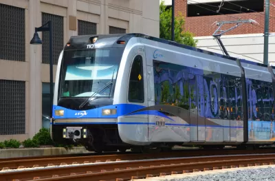
The Charlotte Area Transit System (CATS) "wants to build a rail line – known as the Silver Line — from Matthews to uptown, and then continuing to the airport and possibly Belmont," reports Steve Harrison.
The problem is how to route the east-west light-rail line through the center city.
"If the transit system is only focused on moving people, the tunnel is the best option," according to Harrison, who is paraphrasing the explanation of CATS Chief Executive John Lewis. However, that's not the only consideration CATS considered when planning the light rail line.
"Lewis said CATS couldn’t look only at mobility. He said CATS is a part of the city of Charlotte and the city has other goals, like economic development. The area around I-277 is mostly empty today," explains Harrison. "So CATS picked the northern route through uptown. The Silver Line would follow I-277, and then cross over the highway and run along 11th street. It would then turn to the south and run alongside the existing railroad tracks two blocks northwest of Graham Street."
Harrison is able to find multiple sources in positions of power who are disappointed with the decision, as Charlotte prepares to become the latest (but not the only) case study of light rail transit planning that doesn't optimize ridership, and routes a long a freeway.
FULL STORY: Airport Train Route Stirs Concern Because It Avoids Center City

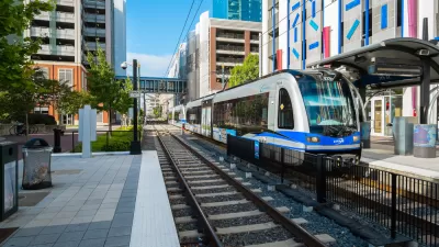
A New 26-Mile Light Rail Line Considered for Charlotte
The Charlotte Area Transit System (CATS) would like to add an ambitious, expensive project to its capital investment plans, but funding the project is more daunting than the last time the system expanded.

Light Rail and Buses and More, Oh My!
A light rail bridge proposed for Lady Bird Lake, still pre-design, is causing controversies about whether adding buses to the bridge would be too dangerous for the other non-automotive modes.

Big Light Rail Expansion Planned in Montreal
Montreal officials recently announced details of a major expansion of the Réseau express métropolitain (REM).

Maui's Vacation Rental Debate Turns Ugly
Verbal attacks, misinformation campaigns and fistfights plague a high-stakes debate to convert thousands of vacation rentals into long-term housing.

Planetizen Federal Action Tracker
A weekly monitor of how Trump’s orders and actions are impacting planners and planning in America.

In Urban Planning, AI Prompting Could be the New Design Thinking
Creativity has long been key to great urban design. What if we see AI as our new creative partner?

King County Supportive Housing Program Offers Hope for Unhoused Residents
The county is taking a ‘Housing First’ approach that prioritizes getting people into housing, then offering wraparound supportive services.

Researchers Use AI to Get Clearer Picture of US Housing
Analysts are using artificial intelligence to supercharge their research by allowing them to comb through data faster. Though these AI tools can be error prone, they save time and housing researchers are optimistic about the future.

Making Shared Micromobility More Inclusive
Cities and shared mobility system operators can do more to include people with disabilities in planning and operations, per a new report.
Urban Design for Planners 1: Software Tools
This six-course series explores essential urban design concepts using open source software and equips planners with the tools they need to participate fully in the urban design process.
Planning for Universal Design
Learn the tools for implementing Universal Design in planning regulations.
planning NEXT
Appalachian Highlands Housing Partners
Mpact (founded as Rail~Volution)
City of Camden Redevelopment Agency
City of Astoria
City of Portland
City of Laramie