


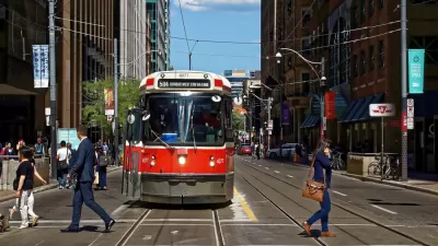
By restricting car traffic and eliminating parking along a portion of King Street in Toronto, streetcar ridership and service performance have been greatly improved.
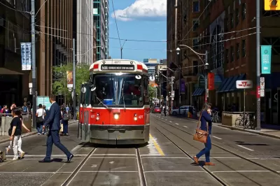
"A $1.5-million pilot project that gives priority to streetcar traffic on King St. between Bathurst and Jarvis Sts. marks its one-year anniversary Monday with [Toronto's] latest data showing a spike in transit ridership, cyclist and pedestrian travel and a slight improvement in customer spending in the busy downtown corridor," reports Michael Lewis.
"City of Toronto data for July and August shows double-digit increases in streetcar ridership during the morning and evening commutes on King St. during the period compared to ridership before the project began last Nov. 12, with average all-day ridership jumping by 11 per cent to roughly 80,000 boardings per day," adds Lewis.
Based on those data, and "key metrics" for September and October expected to be made public soon, the city will decide whether to make the pilot project permanent. The news about the King Street project has been positive for ridership and system performance since shortly after the project launched, as past coverage by Planetizen shows.
- An Ambitious Plan to Rethink Toronto's King Street (January 2016)
- In Praise of Toronto's Least Ambitious Transit Project (November 2017)
- Ridership Surges After Streetcars Gain Priority in Toronto (January 2018)
- With Transit Signal Priority Back On, Streetcars Moving Faster in Toronto (September 2018)
For more coverage of the anniversary of the pilot project, see also an article by Angie Schmitt.
FULL STORY: One year in data deems King St. pilot project a success

Toronto Streetcar Experiment Likely to Be Made Permanent
The city of Toronto did something radical and gave its streetcar its own lane on King Street as part of a pilot project launched in 2018. The results included improved service and increased ridership.
Plan to Speed Up Relief Line Construction Pitched in Toronto
Toronto Mayor John Tory is intervening in transit plans with a call to speed up spending and the construction timeline for the relief line, designed to relieve crowding on the city's subway system in the urban core.
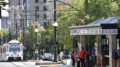
Buslash in Salt Lake City
New bus routes planned for Salt Lake City have provoked a vocal political opposition.

Maui's Vacation Rental Debate Turns Ugly
Verbal attacks, misinformation campaigns and fistfights plague a high-stakes debate to convert thousands of vacation rentals into long-term housing.

Planetizen Federal Action Tracker
A weekly monitor of how Trump’s orders and actions are impacting planners and planning in America.

Chicago’s Ghost Rails
Just beneath the surface of the modern city lie the remnants of its expansive early 20th-century streetcar system.

Bend, Oregon Zoning Reforms Prioritize Small-Scale Housing
The city altered its zoning code to allow multi-family housing and eliminated parking mandates citywide.

Amtrak Cutting Jobs, Funding to High-Speed Rail
The agency plans to cut 10 percent of its workforce and has confirmed it will not fund new high-speed rail projects.

LA Denies Basic Services to Unhoused Residents
The city has repeatedly failed to respond to requests for trash pickup at encampment sites, and eliminated a program that provided mobile showers and toilets.
Urban Design for Planners 1: Software Tools
This six-course series explores essential urban design concepts using open source software and equips planners with the tools they need to participate fully in the urban design process.
Planning for Universal Design
Learn the tools for implementing Universal Design in planning regulations.
planning NEXT
Appalachian Highlands Housing Partners
Mpact (founded as Rail~Volution)
City of Camden Redevelopment Agency
City of Astoria
City of Portland
City of Laramie