


A new interactive map keeps residents up to date on where the San Francisco Municipal Transportation Agency is working on new projects.
The San Francisco Municipal Transportation Agency (SFMTA) has released a new citywide project map, reports Joe Fitzgerald Rodriguez.
This new interactive map can parse projects by category, such as Vision Zero pedestrian safety projects, improvements to bus and light rail lines, parking changes, street redesigns and new bike projects. The SFMTA is currently working on 64 projects that affect bicyclists, from redesigning current bike lanes to be safer to creating brand new bike lanes in The City, according to the new interactive map. A few clicks also reveal the SFMTA is working on 68 Muni-related projects, from new street design changes to make the 14-Rapid speedier to bus stop changes along the 19-Polk route.
According to a source quoted in the article, the city previously used a Google map with a few projects layered on top, but it lacked all the functionality described above.
FULL STORY: City launches neighborhood map of Muni and transit-related street projects

Beleaguered San Francisco Bus Project To Open April 1
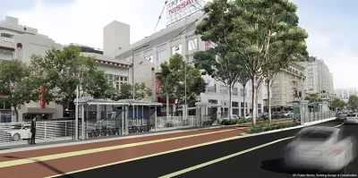
San Francisco's much-delayed Van Ness BRT line, expected to speed up travel along the 'grandest boulevard,' has finally received an opening date.

San Francisco's First BRT Line Closer to Opening
The Van Ness Avenue Bus Rapid Transit project will bring the first dedicated BRT corridor to San Francisco, nearly two decades after voters approved the project.
Once San Francisco's 'Grandest Boulevard,' Van Ness Almost Done With Another Makeover
The Van Ness Improvement project took almost two decades to cross the finish line, but it's almost there.

Planetizen Federal Action Tracker
A weekly monitor of how Trump’s orders and actions are impacting planners and planning in America.

Maui's Vacation Rental Debate Turns Ugly
Verbal attacks, misinformation campaigns and fistfights plague a high-stakes debate to convert thousands of vacation rentals into long-term housing.

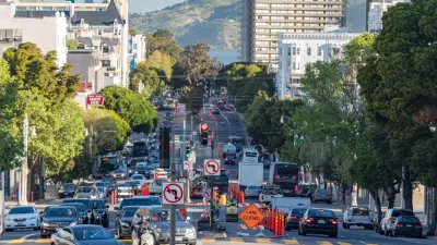
San Francisco Suspends Traffic Calming Amidst Record Deaths
Citing “a challenging fiscal landscape,” the city will cease the program on the heels of 42 traffic deaths, including 24 pedestrians.

Defunct Pittsburgh Power Plant to Become Residential Tower
A decommissioned steam heat plant will be redeveloped into almost 100 affordable housing units.

Trump Prompts Restructuring of Transportation Research Board in “Unprecedented Overreach”
The TRB has eliminated more than half of its committees including those focused on climate, equity, and cities.

Amtrak Rolls Out New Orleans to Alabama “Mardi Gras” Train
The new service will operate morning and evening departures between Mobile and New Orleans.
Urban Design for Planners 1: Software Tools
This six-course series explores essential urban design concepts using open source software and equips planners with the tools they need to participate fully in the urban design process.
Planning for Universal Design
Learn the tools for implementing Universal Design in planning regulations.
Heyer Gruel & Associates PA
JM Goldson LLC
Custer County Colorado
City of Camden Redevelopment Agency
City of Astoria
Transportation Research & Education Center (TREC) at Portland State University
Jefferson Parish Government
Camden Redevelopment Agency
City of Claremont