


These days, cities are expected to make the most of open data and spatial visualization technologies.
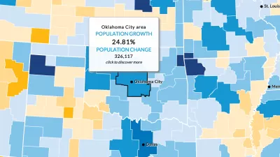
Jim Berry, a gedeveloper advocate at Esri, publishes an article at Smart Cities Dive that offers advice on how cities can better deploy GIS technology.
"There’s a revolution in civic innovation taking place in most major cities around the world, writes Berry, "cities are realizing the need to provide easy access to open spatial data and interactive map apps for partner agencies and local governments."
Beyond making the case for why cities should embrace this revolution (e.g., open data frees up workers and provides data and resources within their daily workflows), Berry lists three steps toward making the most of open data and spatial visualization tools. The first step is to make sense of the data (with easy-to-read maps). The second step is to activate the Internet of Things. Berry sites the Virginia Beach StormSense Project as an example of this approach. The third step is to enable collaboration.
Much more detail is included on each of these approaches in the article.
FULL STORY: 3 steps to make GIS part of a successful smart city


How the National Park Service Uses GIS
A new book demonstrates how the National Park Service uses GIS technology to meet its mission and showcases a selection of maps used for effectively managing national parks.

New Book Shows How Geographic Technology Tackles Global Challenges
In his new book, Jack Dangermond explores the transformative impact of GIS technology in solving global challenges through spatial data, highlighting its widespread application across sectors and its potential to design sustainable futures.
Building Healthier Communities: The Role of GIS in Park Planning
Integrating Geographic Information Systems (GIS) into park planning enhances community health by promoting physical activity, supporting mental well-being, fostering social connectedness, and addressing public health crises and climate change.

Maui's Vacation Rental Debate Turns Ugly
Verbal attacks, misinformation campaigns and fistfights plague a high-stakes debate to convert thousands of vacation rentals into long-term housing.

Planetizen Federal Action Tracker
A weekly monitor of how Trump’s orders and actions are impacting planners and planning in America.

In Urban Planning, AI Prompting Could be the New Design Thinking
Creativity has long been key to great urban design. What if we see AI as our new creative partner?

King County Supportive Housing Program Offers Hope for Unhoused Residents
The county is taking a ‘Housing First’ approach that prioritizes getting people into housing, then offering wraparound supportive services.

Researchers Use AI to Get Clearer Picture of US Housing
Analysts are using artificial intelligence to supercharge their research by allowing them to comb through data faster. Though these AI tools can be error prone, they save time and housing researchers are optimistic about the future.

Making Shared Micromobility More Inclusive
Cities and shared mobility system operators can do more to include people with disabilities in planning and operations, per a new report.
Urban Design for Planners 1: Software Tools
This six-course series explores essential urban design concepts using open source software and equips planners with the tools they need to participate fully in the urban design process.
Planning for Universal Design
Learn the tools for implementing Universal Design in planning regulations.
planning NEXT
Appalachian Highlands Housing Partners
Mpact (founded as Rail~Volution)
City of Camden Redevelopment Agency
City of Astoria
City of Portland
City of Laramie