


Looking at Census data for urbanized areas and auto ownership, Randal O'Toole argues that denser areas have high rates of auto ownership per square mile, a correlation that is likely to increase congestion.
"Among urban areas, the highest auto densities are found in San Francisco-Oakland (4,000 veh/sq mi), San Jose (3,900), and Los Angeles (3,800). The New York-Northern New Jersey urban area only has about 2,200 cars per square mile, but that covers more than 3,300 square miles of land outside of Manhattan, including most of Long Island and parts of New Jersey more than 100 miles south of New York City. The Houston urban area has just 1,700 cars per square mile.
About a dozen incorporated cities and towns have higher auto densities than Manhattan, led by Guttenberg, NJ at 20,600 veh/sq mi and West Hollywood, CA at 13,900 veh/sq mi. Then there is Friendship Village, MD, the highest-density "census-defined place" in America, a small group of high rises housing 82,000 people and 45,000 cars per square mile (though in fact the whole place occupies less than a tenth of a square mile). In general, higher population densities may have lower auto ownership rates but they are still tend to be associated with higher auto densities per square mile. So much for reducing congestion by increasing population densities."
O'Toole's analysis points to relatively low rates of auto ownership in high density areas, but suggests that these areas have disproportionately high concentrations of cars that create the conditions for traffic congestion.
FULL STORY: A Free Parking Space Grows in Manhattan

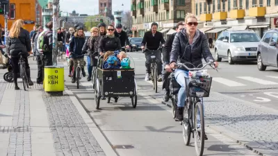
What's Behind Copenhagen's Success as a Cycling City?
Denmark's capital is a model city in terms of biking, but the reasons that bikes rule go beyond political leadership and robust infrastructure.
Where Will We All Park? A Slightly Premature Case Study of Hoboken, New Jersey
Hoboken, New Jersey's Department of Transportation and Parking Director Ian Sacs offers this profile of his city and discusses how the dense but car-enamored city is trying to tackle the contemporary urban parking problem.
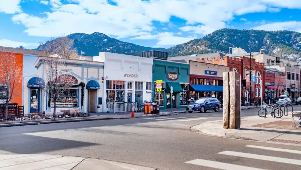
Boulder Eliminates Parking Minimums Citywide
Officials estimate the cost of building a single underground parking space at up to $100,000.

Planetizen Federal Action Tracker
A weekly monitor of how Trump’s orders and actions are impacting planners and planning in America.

Maui's Vacation Rental Debate Turns Ugly
Verbal attacks, misinformation campaigns and fistfights plague a high-stakes debate to convert thousands of vacation rentals into long-term housing.

San Francisco Suspends Traffic Calming Amidst Record Deaths
Citing “a challenging fiscal landscape,” the city will cease the program on the heels of 42 traffic deaths, including 24 pedestrians.

Defunct Pittsburgh Power Plant to Become Residential Tower
A decommissioned steam heat plant will be redeveloped into almost 100 affordable housing units.

Trump Prompts Restructuring of Transportation Research Board in “Unprecedented Overreach”
The TRB has eliminated more than half of its committees including those focused on climate, equity, and cities.

Amtrak Rolls Out New Orleans to Alabama “Mardi Gras” Train
The new service will operate morning and evening departures between Mobile and New Orleans.
Urban Design for Planners 1: Software Tools
This six-course series explores essential urban design concepts using open source software and equips planners with the tools they need to participate fully in the urban design process.
Planning for Universal Design
Learn the tools for implementing Universal Design in planning regulations.
Heyer Gruel & Associates PA
JM Goldson LLC
Custer County Colorado
City of Camden Redevelopment Agency
City of Astoria
Transportation Research & Education Center (TREC) at Portland State University
Jefferson Parish Government
Camden Redevelopment Agency
City of Claremont