


As in metropolitan New York, big, dense cities don't always suffer from coronavirus to a greater extent than their car-oriented suburbs.

Most dialogue about the relationship between urbanism and coronavirus can be summarized in the following semi-imaginary conversation:
ANTI-URBANIST: Disease spreads through transit! New York City has subways and density and has more disease than anyone else, so subways and density are bad!
URBANIST: The disease isn't worst in Manhattan where most people don't have cars, but in the suburbs and in the outer boroughs. And also, Hong Kong and Singapore have about as many COVID-19 deaths as North Dakota. So you are just plain wrong."*
What's wrong with this dialogue? Among other things, it treats New York as unique, presupposing that density and transit are something that only exists in NYC (bad according to Anti-Urbanist, good according to Urbanist).
But in fact, there are several U.S. cities which have historically had above-average transit ridership (roughly 20-35 percent of commuters) and unusually high density (about 10-20,000 people per square mile): Boston, Chicago, Washington, Philadelphia, and San Francisco. Because the latter three are coterminous with counties, more data is available for them than for Boston and Chicago. Are these cities more virus-ridden than their suburbs? Not necessarily.
San Francisco is the second most dense major city in the United States, with over 18,000 residents per square mile. 33 percent of city residents use public transit to get to work, as opposed to just under 2 percent in affluent Marin County to its north (and just over 2 percent in San Mateo and Santa Clara Counties nearby). In this respect, San Francisco differs far more from its own suburbs than New York differs from its suburbs. So one might think that if any non-New York city was hit especially hard by COVID-19, that city would be San Francisco.
But as of April 26, San Francisco has only 2.5 deaths per 100,000 people—about the same amount as lower-density places like Nashville, Tennessee (3.2) and Dallas County, Texas (3.1). Marin County is slightly worse off, with 4.7 deaths per 100,000; Silicon Valley’s Santa Clara County and nearby San Mateo County also have suffered more than the central city, with just over 5 deaths per 100,000. All of these counties have suffered less than sprawling Los Angeles County, which has 8.9 deaths per 100,000 people. (Unless otherwise noted, most data is from the New York Times COVID-19 tracker).
The data from Philadelphia is a bit unclear. According to the Times, Philadelphia (which is coterminous with Philadelphia County) has 29.6 deaths per 100,000. Neighboring Montgomery County has almost as many (26.1 per 100,000, despite being far more affluent than the city of Philadelphia, and despite having much lower transit use (5 percent of commuters as opposed to Philadelphia’s 26 percent). Slightly less affluent Delaware County similarly has 25.2 deaths per 100,000. However, state Department of Health data shows a different picture: it shows 272 deaths (or roughly 18 per 100,000 residents) in Philadelphia, while the suburban counties have death rates similar to those listed by the Times.
In Washington, by contrast, the city/suburb gap is more significant. The core city (District of Columbia) has 24.1 deaths per 100,000. Its Maryland suburbs have suffered less: Montgomery County has 14.8 deaths per 100,000; Prince George's County has 17.9. However, these differences are far smaller than the differences between Washington and hard-hit metro areas like New Orleans and New York. For example, Nassau, Westchester and Rockland (three of New York City's suburban counties) all have over 100 deaths per 100,000 people.
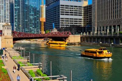
Chicago has 708 deaths so far, or 24 deaths per 100,000. By contrast, Lake County just to the north has 16.3 deaths per 100,000, and DuPage County has 13.6 deaths per 100,000. Again, Chicago is somewhat worse off than its suburbs but not at all comparable to New York's suburbs.
Data from Boston is a little less useful, because Boston is part of a county which includes suburban territory. However, Suffolk County (which includes Boston) does not appear to have suffered more than nearby counties that are purely suburban (and have much lower transit mode shares). In Massachusetts, Suffolk's death rate of 43 per 100,000 residents is lower than that of nearby Norfolk (47) and far lower than that of Hampden County (which includes Springfield, and has 60 deaths per 100,000).
In sum, the most classically urban metro areas appear to have a wide range of COVID-19 fatality rates. San Francisco clearly has suffered less than its suburbs, while Chicago and Washington have suffered somewhat more. Philadelphia's data is unclear, while Boston seems to be roughly comparable to its suburbs.
Why the differences? I suspect that one factor might be poverty. In New York, the poorest borough (the Bronx) has the highest death rate. San Francisco is the most highly gentrified of this group, while the other cities all have significantly higher poverty rates than their suburbs. So I suspect that if we control for poverty, the city-suburb gaps in places like Washington and Chicago might disappear.
*If you want to see an enormous number of counter-arguments, counter-counter arguments, and counter-counter-counter arguments, I recommend the Market Urbanism Report Facebook group.

Poll: One-Third of Americans Thinking of Moving to Less Densely Populated Areas
In the midst of the pandemic, Americans are expressing a new preference for less crowded spaces, according to the results of a Harris Poll conducted last week.

Study: Poor Air Quality Fuels COVID Transmission
Communities exposed to higher levels of air pollution experience higher rates of infection, particularly in areas with high population density.
'Never Let a Good Crisis Go to Waste' and Planning in the Pandemic
The latest in a series of compendia collecting news and commentary focusing on the complexities of the COVID-19 pandemic's effect on communities.

Maui's Vacation Rental Debate Turns Ugly
Verbal attacks, misinformation campaigns and fistfights plague a high-stakes debate to convert thousands of vacation rentals into long-term housing.

Planetizen Federal Action Tracker
A weekly monitor of how Trump’s orders and actions are impacting planners and planning in America.

In Urban Planning, AI Prompting Could be the New Design Thinking
Creativity has long been key to great urban design. What if we see AI as our new creative partner?

How Trump's HUD Budget Proposal Would Harm Homelessness Response
Experts say the change to the HUD budget would make it more difficult to identify people who are homeless and connect them with services, and to prevent homelessness.

The Vast Potential of the Right-of-Way
One writer argues that the space between two building faces is the most important element of the built environment.

Florida Seniors Face Rising Homelessness Risk
High housing costs are pushing more seniors, many of them on a fixed income, into homelessness.
Urban Design for Planners 1: Software Tools
This six-course series explores essential urban design concepts using open source software and equips planners with the tools they need to participate fully in the urban design process.
Planning for Universal Design
Learn the tools for implementing Universal Design in planning regulations.
Gallatin County Department of Planning & Community Development
Heyer Gruel & Associates PA
JM Goldson LLC
City of Camden Redevelopment Agency
City of Astoria
Transportation Research & Education Center (TREC) at Portland State University
Jefferson Parish Government
Camden Redevelopment Agency
City of Claremont