


Not all bike routes are created equal; some are just mellower.
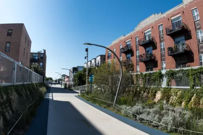
John Greenfield announces a new "Mellow Chicago Bike Map," which is published in an article for Chicago Reader.
Greenfield places the Mellow Map in context of the city's 300 miles of on-street bikeways and a "relentless street grid" that offers a lot of options. That being said, some routes across the city on two wheels are just mellower than others.
I picked the streets highlighted on this map based on the city's bike map, Google Maps, suggestions from local cyclists, and my nearly three decades of navigating our city on two wheels. While I think these routes are generally better for bicyclists, you still should be careful anytime you ride in the city.
FULL STORY: The Mellow Chicago Bike Map: Our guide to the lowest-stress routes in the city


Friday Eye Candy: Bike Maps That Look Like Transit Maps
Stylized maps of bike routes, similar to the example set my London transit maps. This is the best kind of mashup.

Chicago Sees Record Shared Bike, Scooter Use
Riders took over 11 million bike share and scooter trips in 2024.

Winter Cyclists Test Out New Chicago Bike Lanes
A new protected bike lane in the Logan Square neighborhood is seeing significant use, even in below-freezing temperatures.

Maui's Vacation Rental Debate Turns Ugly
Verbal attacks, misinformation campaigns and fistfights plague a high-stakes debate to convert thousands of vacation rentals into long-term housing.

Planetizen Federal Action Tracker
A weekly monitor of how Trump’s orders and actions are impacting planners and planning in America.

In Urban Planning, AI Prompting Could be the New Design Thinking
Creativity has long been key to great urban design. What if we see AI as our new creative partner?

King County Supportive Housing Program Offers Hope for Unhoused Residents
The county is taking a ‘Housing First’ approach that prioritizes getting people into housing, then offering wraparound supportive services.

Researchers Use AI to Get Clearer Picture of US Housing
Analysts are using artificial intelligence to supercharge their research by allowing them to comb through data faster. Though these AI tools can be error prone, they save time and housing researchers are optimistic about the future.

Making Shared Micromobility More Inclusive
Cities and shared mobility system operators can do more to include people with disabilities in planning and operations, per a new report.
Urban Design for Planners 1: Software Tools
This six-course series explores essential urban design concepts using open source software and equips planners with the tools they need to participate fully in the urban design process.
Planning for Universal Design
Learn the tools for implementing Universal Design in planning regulations.
planning NEXT
Appalachian Highlands Housing Partners
Mpact (founded as Rail~Volution)
City of Camden Redevelopment Agency
City of Astoria
City of Portland
City of Laramie