Transit planners with the Los Angeles County Metropolitan Transportation Authority have recommended light rail for the planned East San Fernando Valley Transit Corridor Project.


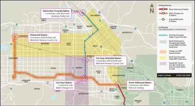
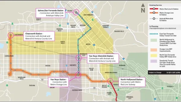
Los Angeles Metro staff recently completed a draft Environmental Impact Statement/Environmental Impact Report on the East San Fernando Valley Transit Corridor Project. The draft EIS/EIR recommends a 9.5-mile light rail route connecting the Sylmar/San Fernando Metrolink Station to the Metro Orange Line via Van Nuys Boulevard and San Fernando Road.
Antonio Pacheco reports on the details of the planned project, noting its potential to transform transit infrastructure San Fernando Valley, currently including two subway stops and a bus rapid transit corridor in addition to typical bus service. "With a bit of luck, the proposed route also has the potential to definitively link the valley with the rest of Los Angeles, depending on which alignment is chosen for other forthcoming high-profile project routes," reports Pacheco, referring to the Sepulveda Pass project, which could someday connect the valley to the city's Westside along the I-405 alignment.
The Metro Board is expected to consider the recommendations of the draft EIR/EIS before the end of the month.
Read the full story: L.A. is one step closer to bringing light rail to the San Fernando Valley

Funding for Two Transit Projects Approved for the Valley in Los Angeles
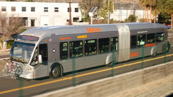
Local funding for a new light rail line and upgrades to the G Line (née Orange Line) bus rapid transit route have been approved for the San Fernando Valley in Los Angeles.

Environmental Review for Light Rail Through The Valley Approved
The B Line subway includes two stops in the San Fernando Valley in Los Angeles, but other than that, commuter rail and buses are the only options for transit. New light rail plans could change that.
$1.9 Billion in State Budget Surplus Requested for L.A. Transit Projects
L.A. transit officials hope the state budget surplus can be used to fund regional transit project, including one highly anticipated light rail project that broke ground on Friday, December 2.

Planetizen Federal Action Tracker
A weekly monitor of how Trump’s orders and actions are impacting planners and planning in America.

California plans to bury El Niño’s downpour
If the state plays its cards right, it may be able to store a billion acre-feet of El Niño’s water in aquifers.

Chicago breaks ground on $3 billion megadevelopment
The new neighborhood, titled Foundry Park, will one day host 3,700 residences.

Satanic place names
From streams and lakes to valleys and canyons, I mapped more than 1,000 places named after the Devil.

California High-Speed Rail Authority CEO resigns after $600,000 scandal
Under Ian Choudri, the authority used taxpayer dollars to fund first class flights and trips to nightclubs.

Want to study the Missouri River? Soon, you may need unanimous approval from 10 states
Legislation would require 10 governors’ permission to study or build projects moving water outside the basin.

FREE Course: Walkable City 1: Why Walkability?
After describing his path towards focusing on walkability as the essence of good planning, Jeff Speck marches through his five principal reasons for making more walkable places.
Reinventing Malls: Planning Alchemy—Turning Gray Fields Into Gold
The course focuses on the opportunities and imperatives that shape reinvention of mall sites.

City of Rosemead
Rutgers University, Edward J. Bloustein School of Planning and Public Policy
One Hundred Miles
Hunter College, City University of New York (CUNY)
The Architects Foundation
University of Cincinnati Online
City of Cambridge
Montrose County
The Pocatello Development Authority