


The proposed 10-mile Jefferson Parkway expansion would cross land once home to the Rocky Flats nuclear weapons plant—site of one of the country's largest environmental crimes.
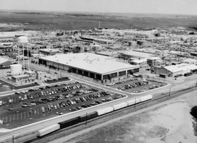
A new report predicts an economic windfall if the proposed Jefferson Parkway is completed to connect quickly growing suburban areas to the West of Denver.
"A newly released report says that completing the embattled 10-mile Jefferson Parkway would give a $1.2 billion jolt to Jefferson County over a 20-year period, a nearly 17 percent premium over what the area would receive without the highway," reports John Aguilar.
According to the report, "the proposed road would boost the amount of office and retail space in the parkway corridor from 2018 to 2037 to 7.6 million square feet from a projected 6.5 million square feet should the highway not be built."
Littleton-based Development Research Partners shared the study with county of Jefferson officials earlier in October. Supporters of the highway plan say the current road is unsafe and inadequate for the growing population in Jefferson County. Critics of the plan say the highway project would disturb plutonium potentially buried in the ground—a legacy of the Rocky Flats nuclear weapons plant that closed in 1992.
FULL STORY: Jefferson Parkway could inject $1.2 billion of economic life into Jeffco over 20 years, study says

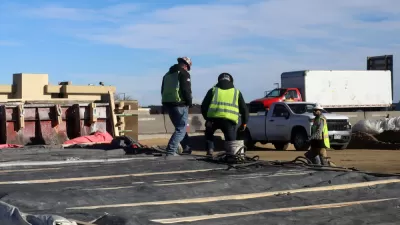
Road and Highway Construction Plan Expected to Take a $250 Million Hit in Colorado
The Colorado Department of Transportation might be building fewer roads than they had originally planned after the coronavirus recedes. A few projects already underway have been able to speed up.
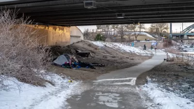
First Steps to Combat Homelessness in Denver Suburbs
Efforts are underway in several Denver suburbs to quantify and respond to growing homelessness.

How Not to Do Growth
The state of Florida is moving forward with the Multi-use Corridors of Regional Economic Significance (M-Cores) plan to build several new toll expressways in rural parts of the state.

Maui's Vacation Rental Debate Turns Ugly
Verbal attacks, misinformation campaigns and fistfights plague a high-stakes debate to convert thousands of vacation rentals into long-term housing.

Planetizen Federal Action Tracker
A weekly monitor of how Trump’s orders and actions are impacting planners and planning in America.

Chicago’s Ghost Rails
Just beneath the surface of the modern city lie the remnants of its expansive early 20th-century streetcar system.

Bend, Oregon Zoning Reforms Prioritize Small-Scale Housing
The city altered its zoning code to allow multi-family housing and eliminated parking mandates citywide.

Amtrak Cutting Jobs, Funding to High-Speed Rail
The agency plans to cut 10 percent of its workforce and has confirmed it will not fund new high-speed rail projects.

LA Denies Basic Services to Unhoused Residents
The city has repeatedly failed to respond to requests for trash pickup at encampment sites, and eliminated a program that provided mobile showers and toilets.
Urban Design for Planners 1: Software Tools
This six-course series explores essential urban design concepts using open source software and equips planners with the tools they need to participate fully in the urban design process.
Planning for Universal Design
Learn the tools for implementing Universal Design in planning regulations.
planning NEXT
Appalachian Highlands Housing Partners
Mpact (founded as Rail~Volution)
City of Camden Redevelopment Agency
City of Astoria
City of Portland
City of Laramie