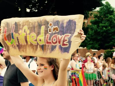
The ongoing project aims to show how LGBT history is embedded throughout the city.

A collaboration of Washington University, the Missouri History Museum, the State Historical Society of Missouri, and the St. Louis LGBT History Project has launched Mapping LGBTQ St. Louis, an interactive online map documenting queer history across the city. Researchers identified 800 sites representing slices of queer life across a nearly 50-year period—including bars and nightclubs, bookstores, places of worship, HIV clinics, cruising spots, protest sites, and locations of police raids and arrests. Clicking on the markers brings up photographs, news clippings, and other background; a time-lapse view by decade is also available.
The site also offers a broader context for the project as a whole. "The distribution of LGBTQ space across metropolitan space wasn't random," researchers explain. "Instead, the geography of St. Louis's LGBTQ spaces has always been related to the region's history of racial segregation, socioeconomic inequality, suburbanization, and urban decline and renewal. St. Louis's LGBTQ history isn't somehow separate from the city's wider history—it's embedded in everything else."
The project accepts public feedback and will continue to grow, eventually representing Pride parades, same-sex marriage, and gay villages. For now, the St. Louis Post-Dispatch reports, it focuses on LGBT life in the city from 1945 ("the beginning of rapid demographic changes in the region") to 1992 ("the year the St. Louis Board of Aldermen passed an ordinance that prohibited discrimination in housing, education and employment because of race, age, religion, disability or sexual orientation.")
FULL STORY: St. Louis gay history unfolds on an interactive map

Maui's Vacation Rental Debate Turns Ugly
Verbal attacks, misinformation campaigns and fistfights plague a high-stakes debate to convert thousands of vacation rentals into long-term housing.

Planetizen Federal Action Tracker
A weekly monitor of how Trump’s orders and actions are impacting planners and planning in America.

In Urban Planning, AI Prompting Could be the New Design Thinking
Creativity has long been key to great urban design. What if we see AI as our new creative partner?

King County Supportive Housing Program Offers Hope for Unhoused Residents
The county is taking a ‘Housing First’ approach that prioritizes getting people into housing, then offering wraparound supportive services.

Researchers Use AI to Get Clearer Picture of US Housing
Analysts are using artificial intelligence to supercharge their research by allowing them to comb through data faster. Though these AI tools can be error prone, they save time and housing researchers are optimistic about the future.

Making Shared Micromobility More Inclusive
Cities and shared mobility system operators can do more to include people with disabilities in planning and operations, per a new report.
Urban Design for Planners 1: Software Tools
This six-course series explores essential urban design concepts using open source software and equips planners with the tools they need to participate fully in the urban design process.
Planning for Universal Design
Learn the tools for implementing Universal Design in planning regulations.
planning NEXT
Appalachian Highlands Housing Partners
Gallatin County Department of Planning & Community Development
Mpact (founded as Rail~Volution)
City of Camden Redevelopment Agency
City of Astoria
City of Portland
City of Laramie


